Single night at Deafy Glade in Mendocino National Forest
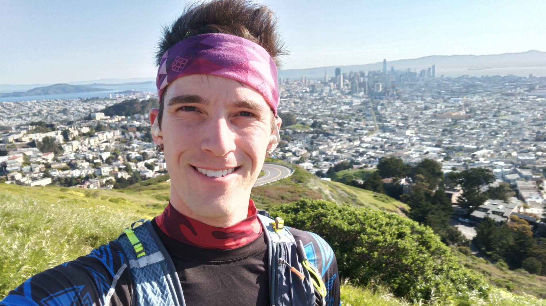
For the first time in a decade, I went backpacking. It was a short trip back up to the Mendocino National Forest, but it was fun. I hope it spurs me to do more soon. I just wish Remi could have been there!
I had been wanting to go camping more for years, but hadn’t quite made the time. This past weekend was a three day one, and I decided the week before to just go somewhere. I thought it’d be just me and Ruffie, as Alan had a music thing and might not want to go anyway. But he ended up going, too, if we could do a single night Sunday to Monday. I hope he’ll want to come on the next one!
In thinking about where to go, I reviewed where I’d been before, which has been mostly in the Mendocino area. I couldn’t believe I basically haven’t gone camping since 2013 if you don’t count Burning Man or one night sleeping in a tent off the highway last year. My tent and packs were intact, as well as one sleeping bag, but I seem to have lost my blow up sleeping pads and a few other things. But I cobbled together enough for Alan and I to hike a bit, and I went without a pad. I did order a couple last minute things, including bear spray and a water filter bottle.
Since I’d been to Mendocino a few times and I also saw it was supposed to be very hot there, I somewhat randomly picked a spot between Yosemite and Tahoe on the map and tried to find a few options. I found a few trailheads that would probably work, though many of their forest service web pages mentioned obstructions on the roadways from the storms this year. I figured it would turn out all right, as long as I didn’t have to impress anyone with a smooth trip!
Then as the weekend approached, basically all of California cooled substantially. Suddenly the place I picked was going to be highs of 50s and lows in the 30s and also have rain. Not having all the right cold weather gear, I opted to switch back to Mendocino. I decided to go to the area near where I’d been, but to try to actually hike to both Snow Mountain peaks this time for a total of either around 10 or 18 miles depending where we started.
I prepared by studying the routes to both the Summit Springs and Deafy Glade trailheads, which both were listed as possibly not accessible due to washouts on the roads. Being unsure about how much water Ruffie would need and knowing there may not be any water above Summit Springs, we ended up aiming for Deafy Glade. That would require an extra 4 miles hiking each way if I still went to the summit, but I was OK if we didn’t.
On the day of, I attempted to follow the web page instructions stating:
Not accessible via M10 Road due to several slides above Fouts Springs. Access to the trailhead is via the M5 Road and 17N02, high-clearance vehicles and 4WD only. Trailers and RV’s are not advised.
So I entered the forest further south than the M10, taking Goat Mountain Road, which was supposed to connect to the M5 and then the 17N02. The Google Map seemed to be correct once I added a set point to get it to route off the M10.
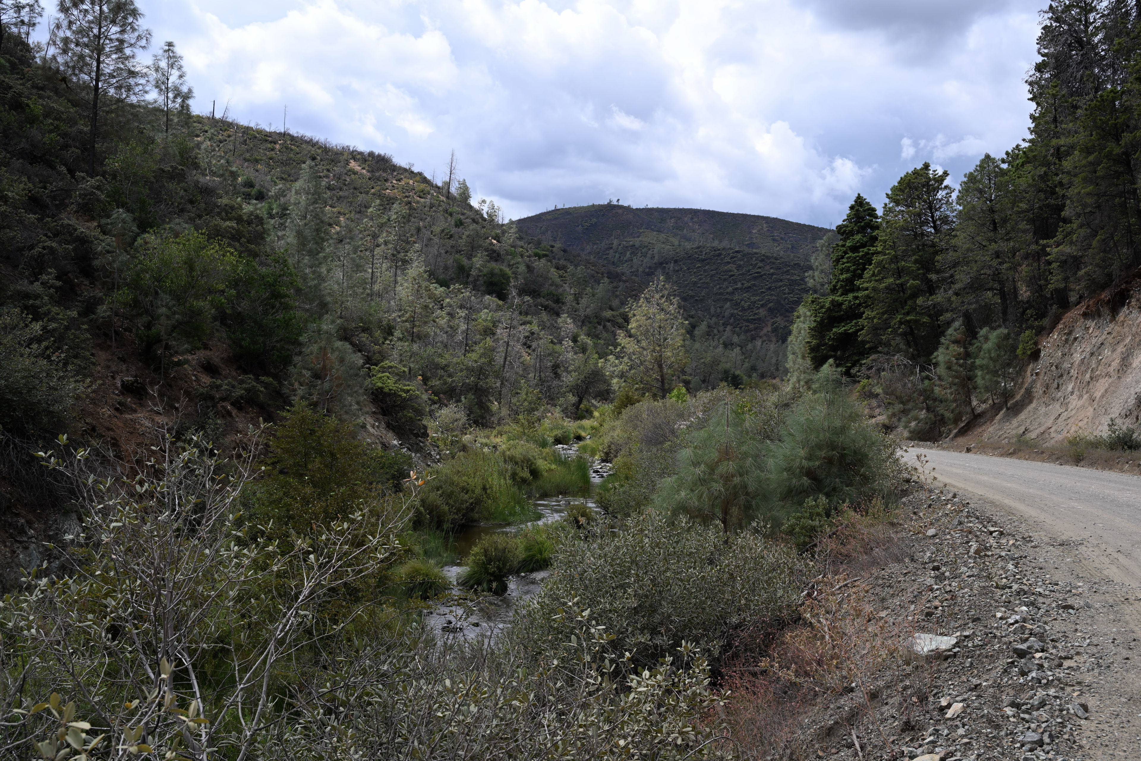
Driving into Mendocino National Forest via Goat Mountain Road
But I did not realize one part of the map had me routed onto a road that was not for normal vehicles.
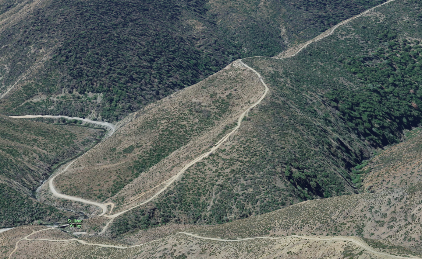
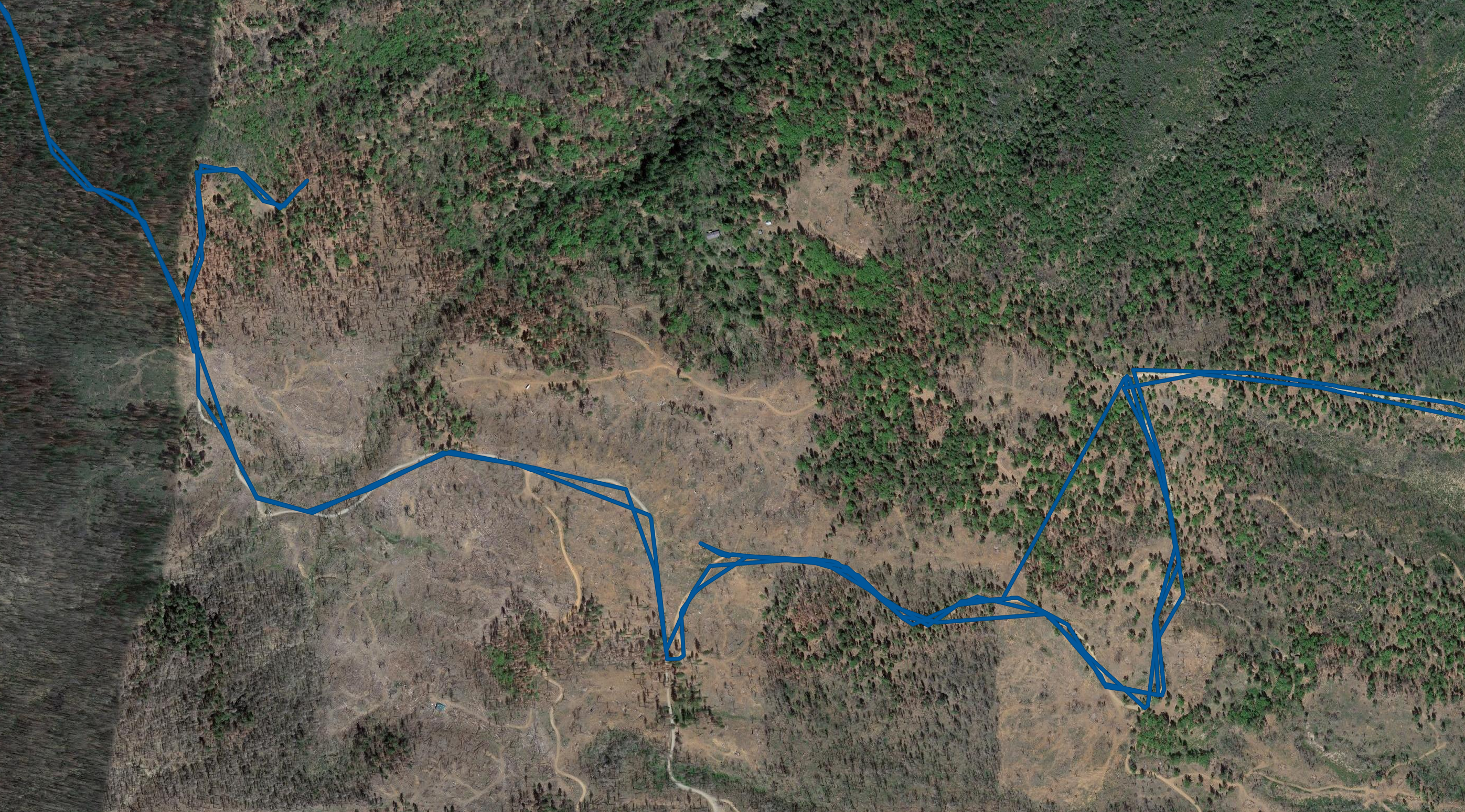
Googe Maps routed us onto what appeared to be an off highway vehicle path. I tried driving up it a bit to get a feel for it, but I chickened out when the slope started increasing a lot. In retrospect I think I could have made it up, but I didn't think it was a good idea in case the path got even steeper and narrower. When I looked this up later, the road was number 85302 connecting to 17N93 up Sullivan Ridge, and it was classified as a 4x4 vehicle path, not an OHV path. It's tempting to go back and try it...
Googe Maps routed us onto what appeared to be an off highway vehicle path. I tried driving up it a bit to get a feel for it, but I chickened out when the slope started increasing a lot. In retrospect I think I could have made it up, but I didn't think it was a good idea in case the path got even steeper and narrower. When I looked this up later, the road was number 85302 connecting to 17N93 up Sullivan Ridge, and it was classified as a 4x4 vehicle path, not an OHV path. It's tempting to go back and try it...
I drove up this little bit and then stopped and got out to assess the situation. I saw the road was getting narrower and steeper, as well as was significantly degraded in the middle.
Googe Maps routed us onto what appeared to be an off highway vehicle path. I tried driving up it a bit to get a feel for it, but I chickened out when the slope started increasing a lot. In retrospect I think I could have made it up, but I didn't think it was a good idea in case the path got even steeper and narrower. When I looked this up later, the road was number 85302 connecting to 17N93 up Sullivan Ridge, and it was classified as a 4x4 vehicle path, not an OHV path. It's tempting to go back and try it...
Googe Maps routed us onto what appeared to be an off highway vehicle path. I tried driving up it a bit to get a feel for it, but I chickened out when the slope started increasing a lot. In retrospect I think I could have made it up, but I didn't think it was a good idea in case the path got even steeper and narrower. When I looked this up later, the road was number 85302 connecting to 17N93 up Sullivan Ridge, and it was classified as a 4x4 vehicle path, not an OHV path. It's tempting to go back and try it...
I ended up chickening out and continuing on, as I saw there should be an alternate way to get to Deafy Glade if I continued on Goat Mountain Road. Later on, I looked at this area on Google Maps aerial view, and it looks pretty interesting.
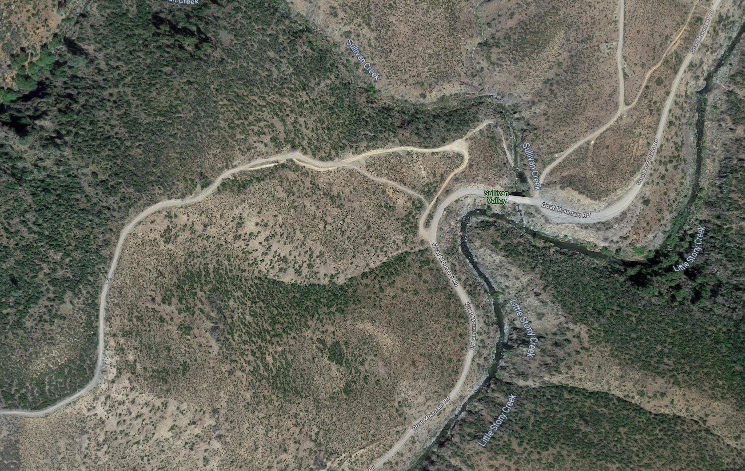
Aerial view of the road up Sullivan Ridge that we decided not to drive.
This is the Google Earth view of the road leading up Sullivan Ridge that I decided not to try. It looks like it would have been fun! https://www.google.com/maps/@39.2869019,-122.586243,362a,35y,213.41h,78.51t/data=!3m1!1e3?entry=ttu
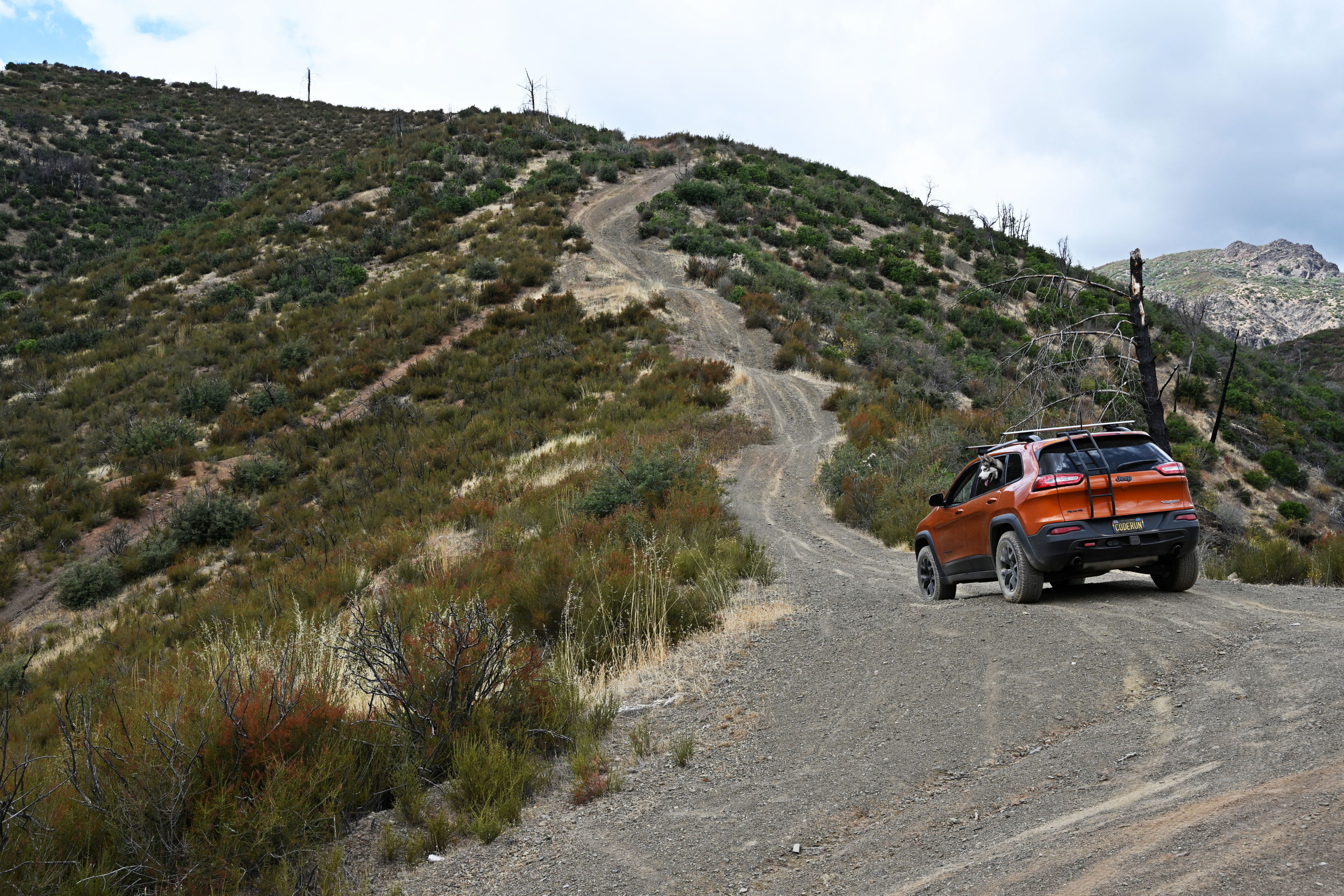
Unfortunately there was more confusion ahead. The Google Maps roads did not match reality. Several parts were marked as a private driveway with a gate across that should have been a public road on the Google Map. One part, the road went up the side of a hill but was not even a dirt road. I tried to drive that bit and would have been fine in my Jeep, but a man in a truck happened to drive by and yelled at me to stay off the private property. I’m not convince it was private, and it wasn’t marked as such, but I continued on the other road as he instructed to find it went around and met where I was trying to go anyway.
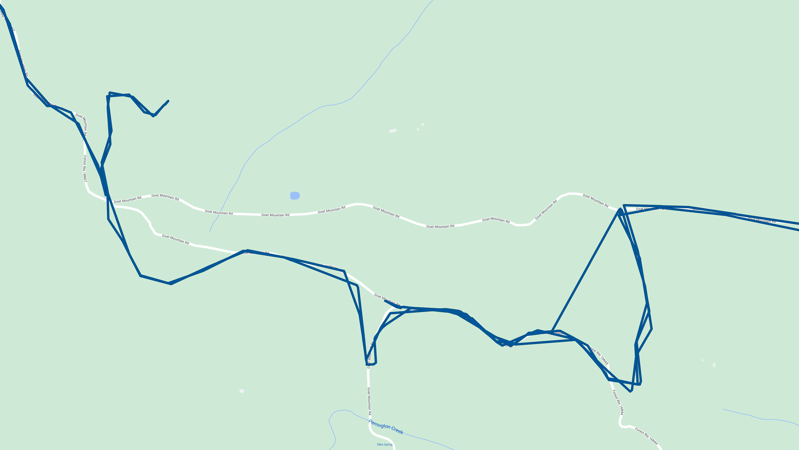
This is the Google Maps picture of our drive through Goat Mountain Road. It's not very accurate, as can be seen from the aerial photo. A large segment of the road is now private property, and another small connector doesn't exist anymore, but was apparently moved further down.
This is the Google Maps picture of our drive through Goat Mountain Road. It's not very accurate, as can be seen from the aerial photo. A large segment of the road is now private property, and another small connector doesn't exist anymore, but was apparently moved further down.
I later found the OpenStreetMaps version of this area was much more correct.
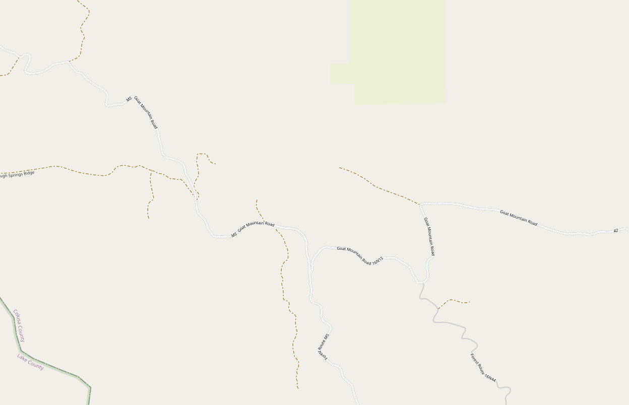
I wish I knew the OpenStreetmap version of this map is much more accurate! https://www.openstreetmap.org/#map=15/39.2493/-122.6730&layers=N
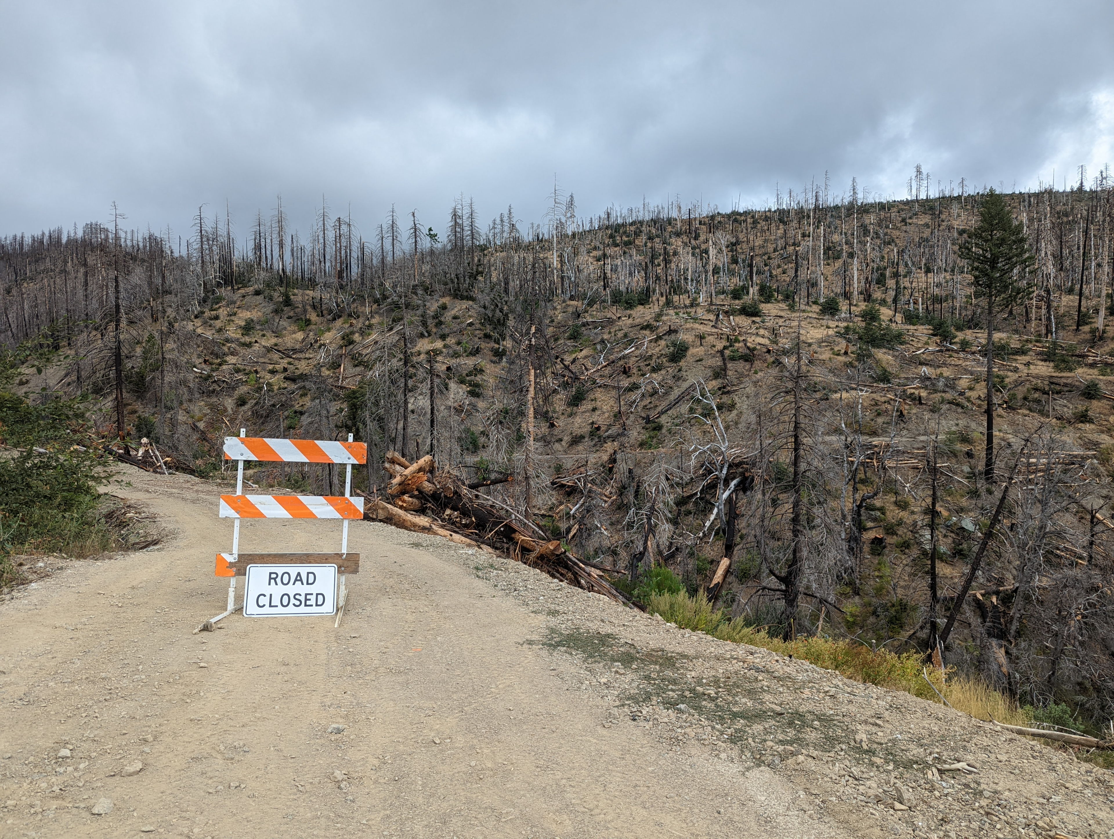
Sadly, after a couple hours of this, I ended up at a road closure just before where Goat Mountain Road was supposed to connect with the M5. At this point I thought we’d have to give up and camp somewhere else, but I decided to first try going back out and in through the M10 to see how far I could get before the supposed washouts.
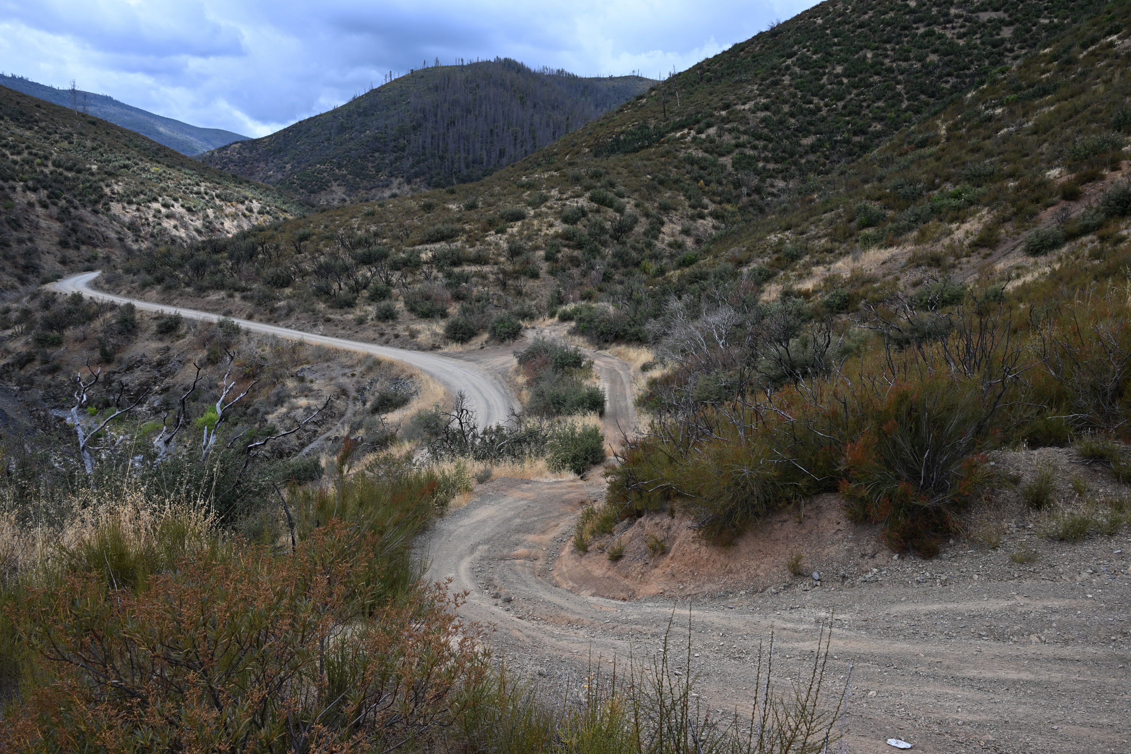
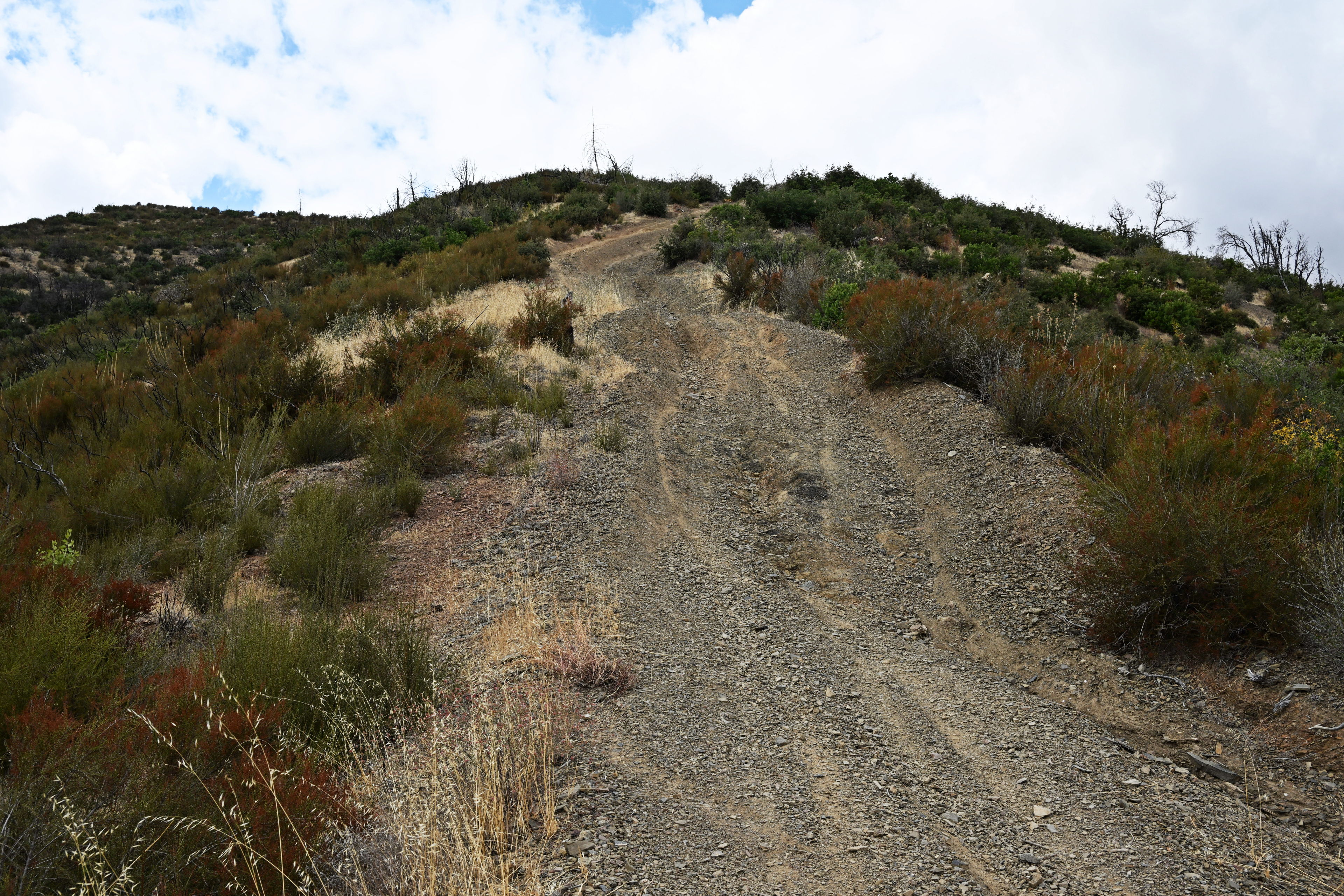
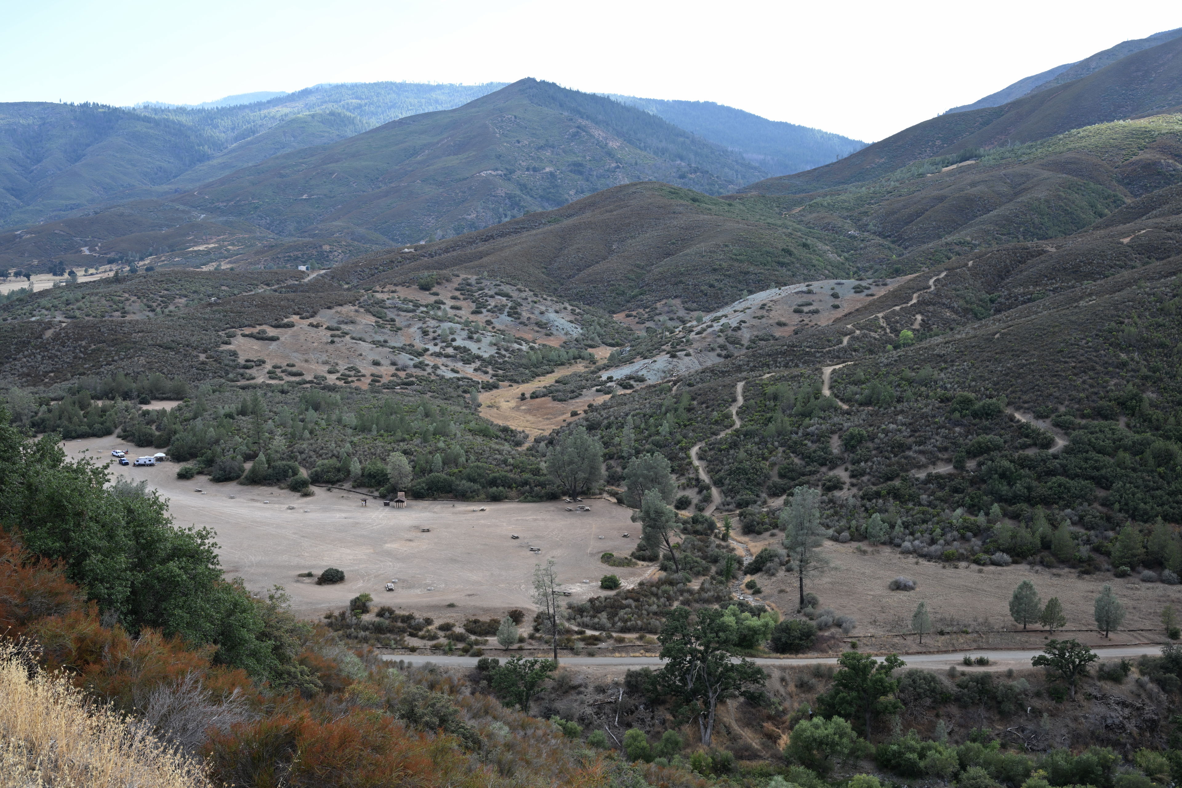
Scenes along Goat Mountain Road in Mendocino National Forest
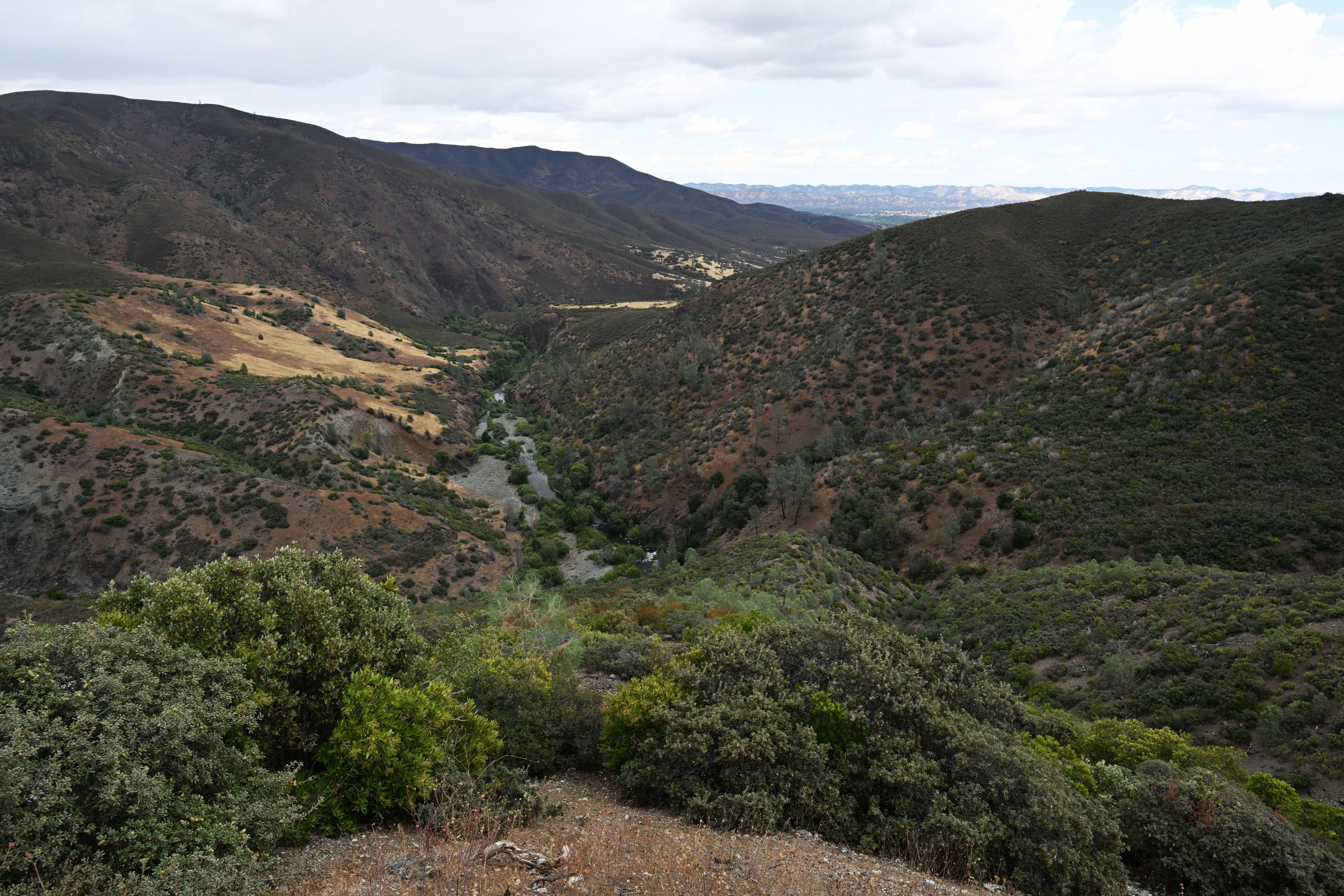
We backtracked and drove north to enter the forest via the M10. This was some of the scenery there.
Once I reached where the M10 branches off to the M5, I decided to make one more attempt to get to Deafy Glade and follow the directions on the web page. We eventually got there, but it took 5 hours longer than it should have!
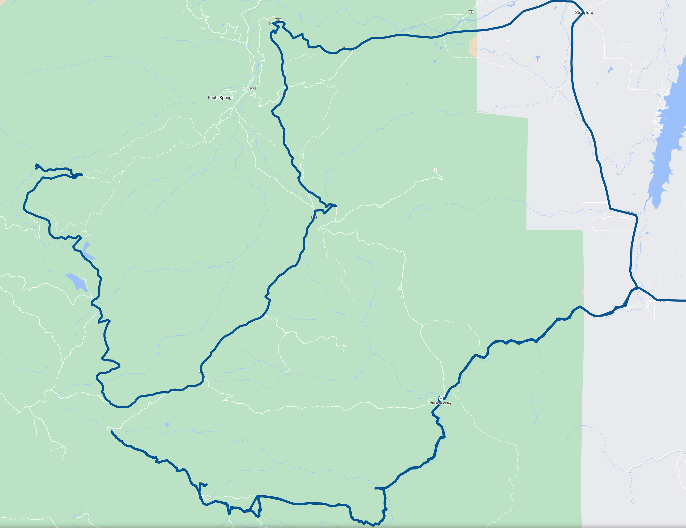
This is the highly inefficient path we took over several hours to get to the Deafy Glade Trailhead, following the advice on the Forest Service web page to avoid M10 due to supposed washouts. It turned out we could not find a way through Goat Mountain Road due to that road having a closure, and then we backtracked to take M10 to M5 down to 17N02, which did work but took a long time!
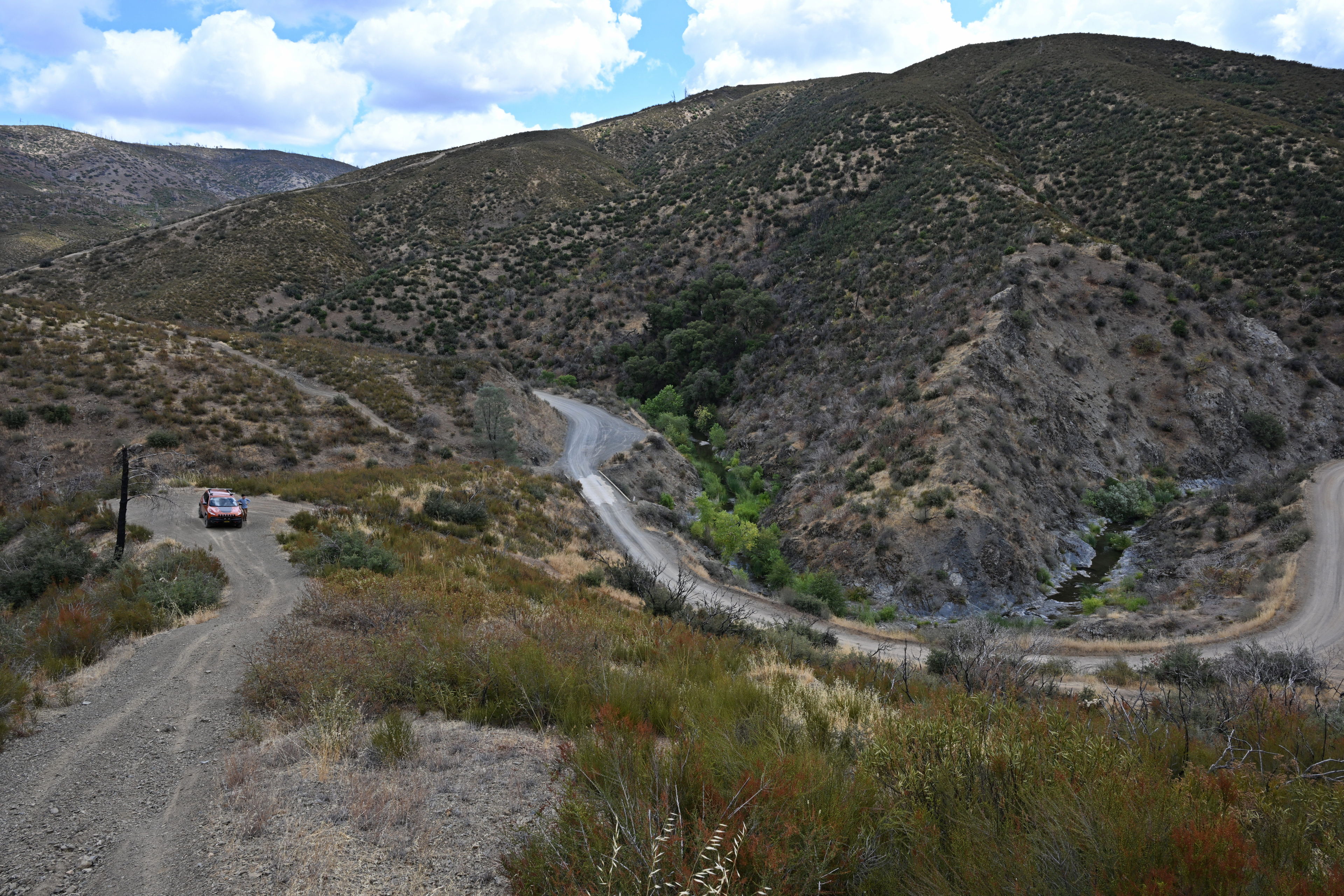
Once we found the trailhead, we parked and got ready to head out. It was already about 16:45, so we’d have just a few hours to hike before we needed to set up camp. I knew we would not make it anywhere near where I had wanted to go, but figured we could decide the next day. According to the sign in sheet, there had only been about a dozen people here in the past 3 months, but possibly one other group was out there today.
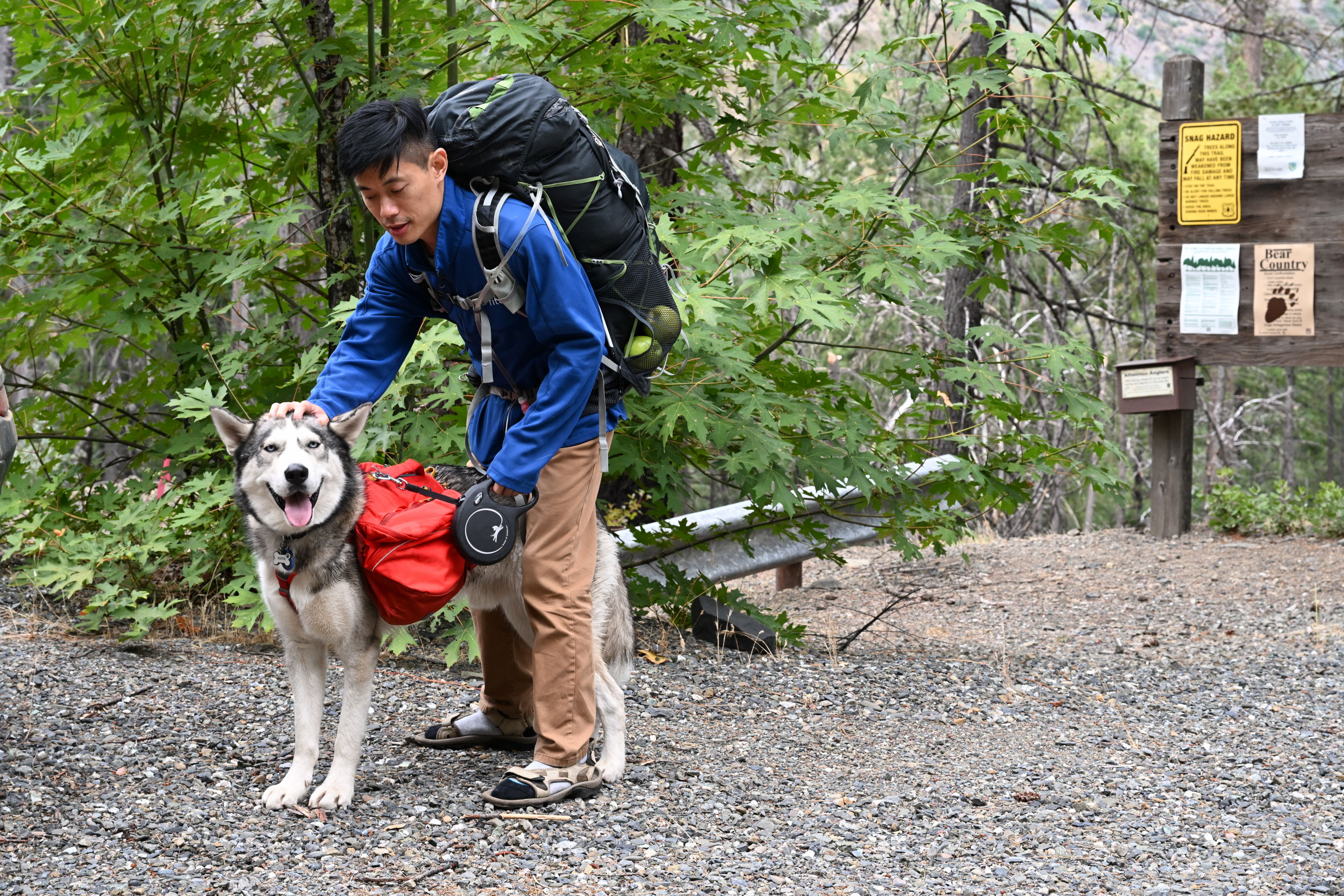
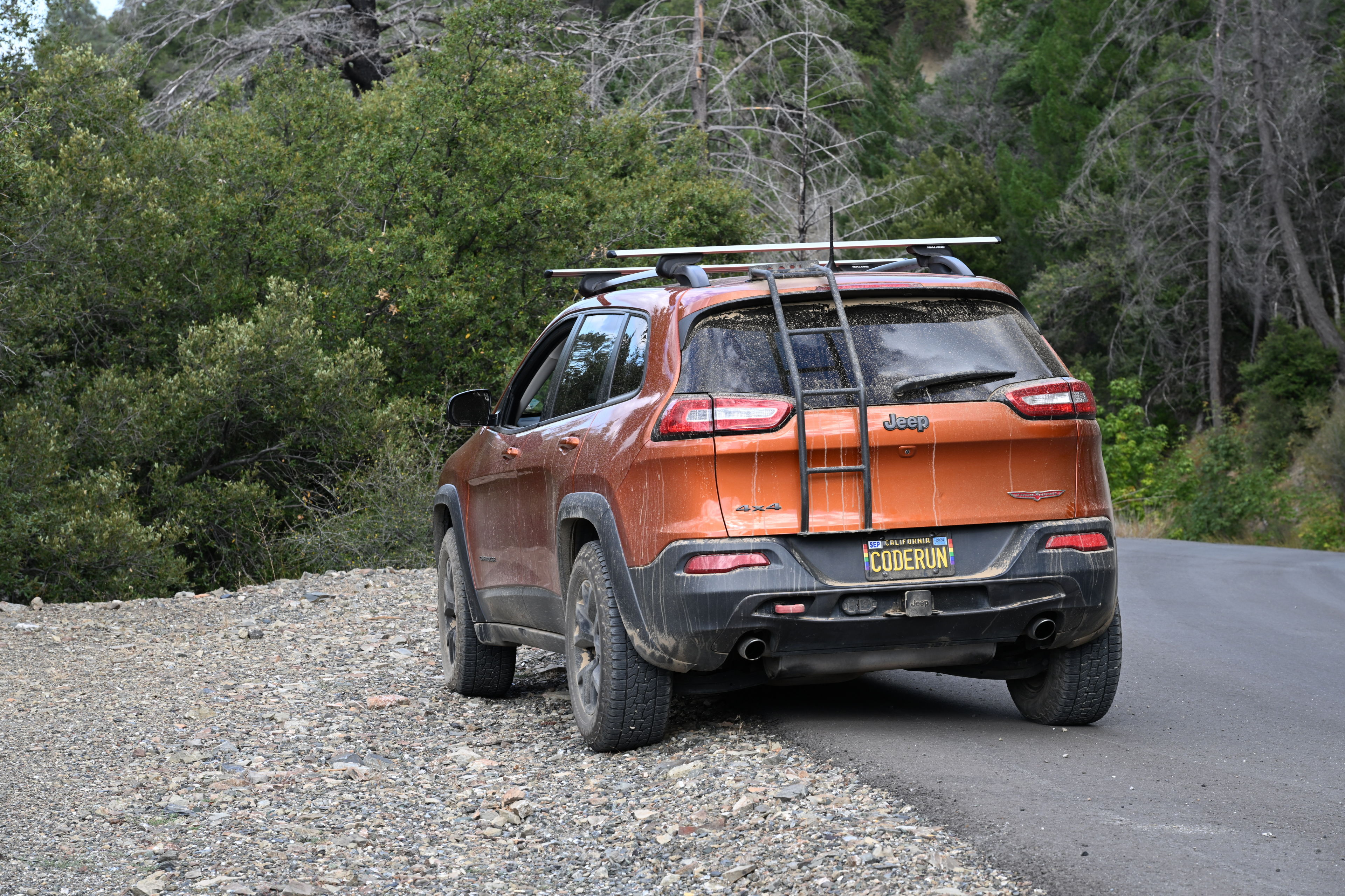
We finally made it to the Deafy Glade Trailhead after much more intense driving than I expected.
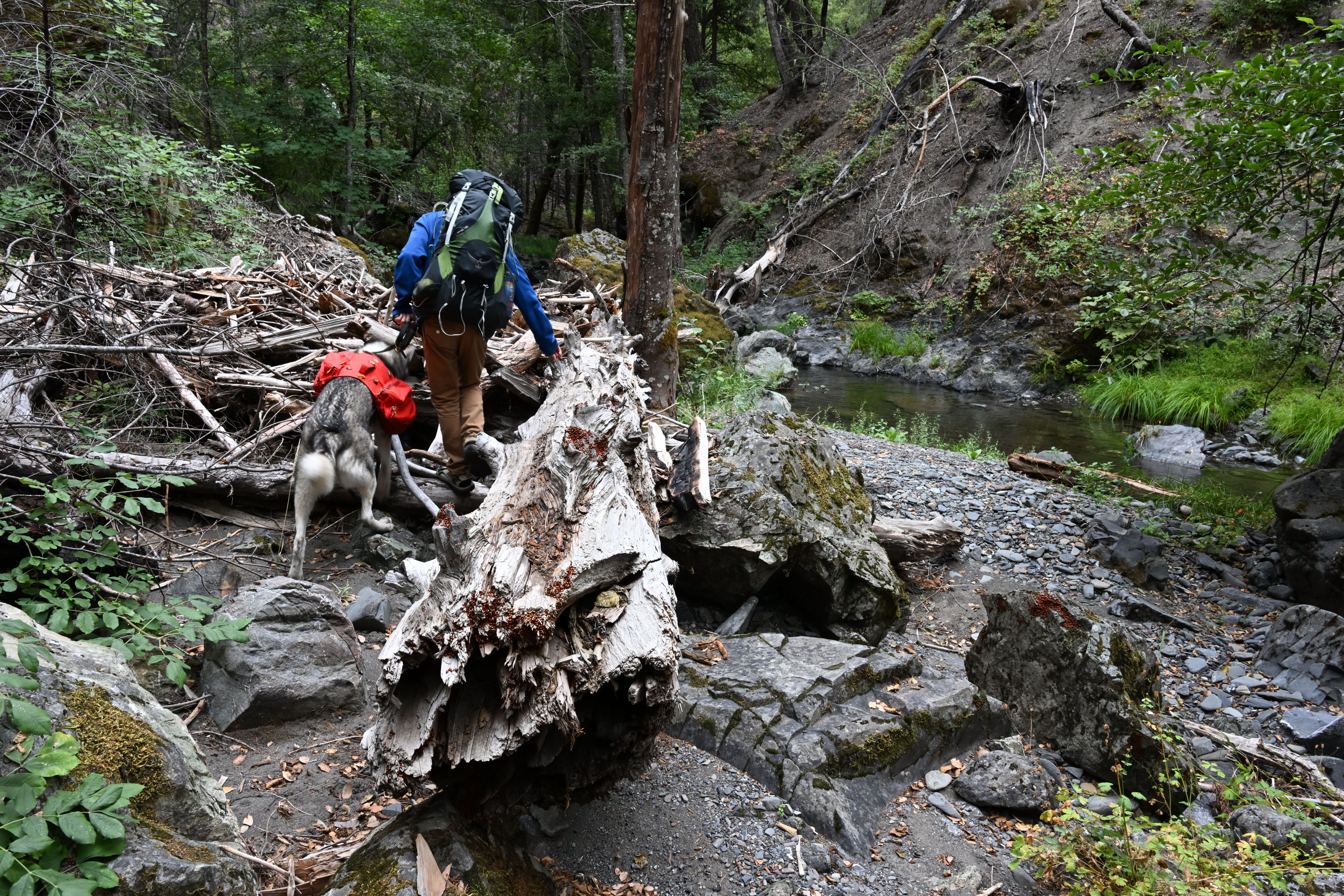
The trail was very rough, especially in the first mile. I expected downed trees, but there was also a lot of thicket we had to push through. I had to put on jeans instead of shorts for some of it. It was pretty easy to stay on the trail, though, until we lost it where it crossed a stream.
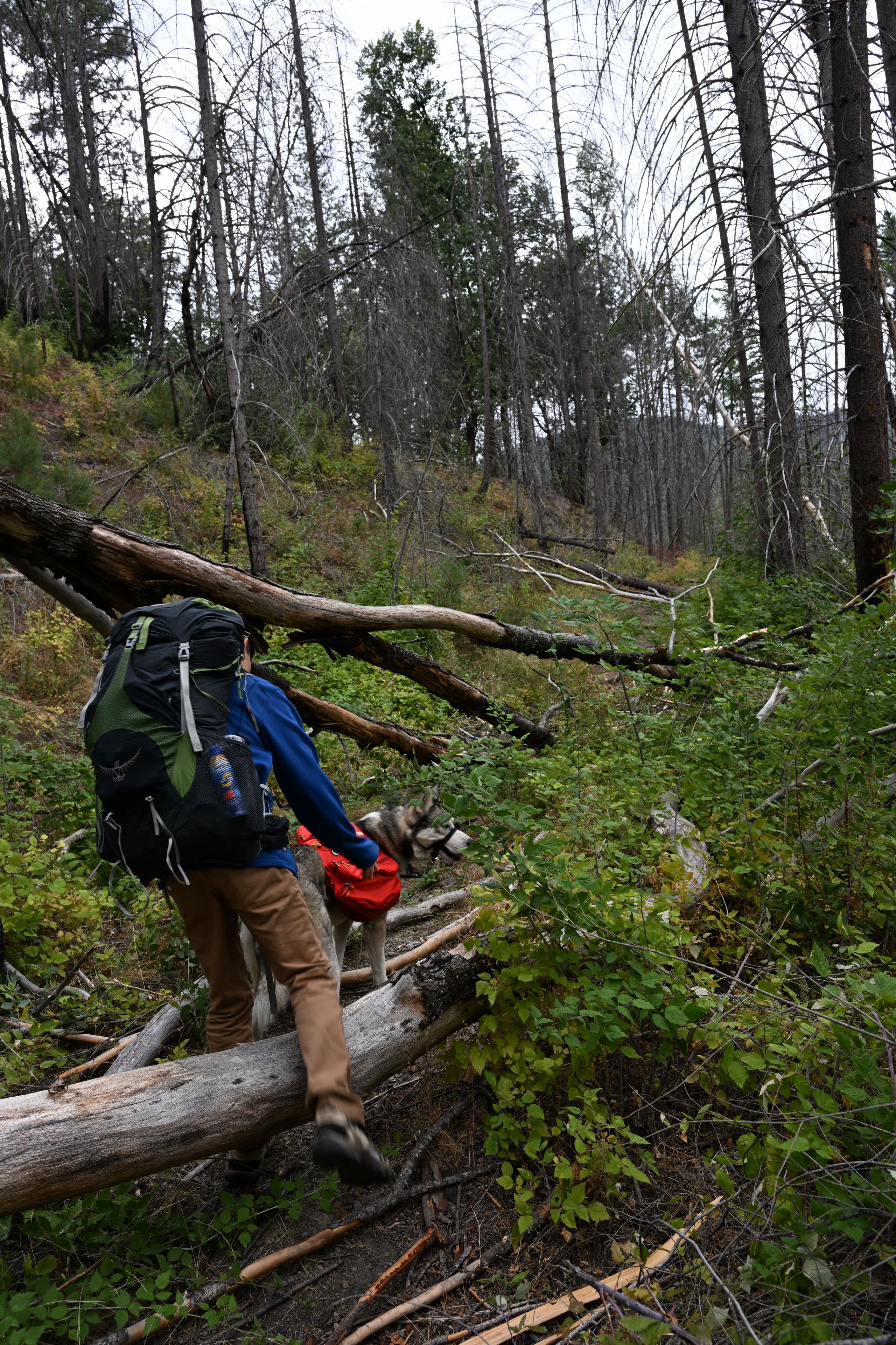
The early part especially of the Deafy Glade Trail, 8W26, in Mendocino National Forest, was in rough condition. We had to do a bit of bushwhacking through thistles, thorned bushes and burrs to get through. And of course we climed over many downed trees.
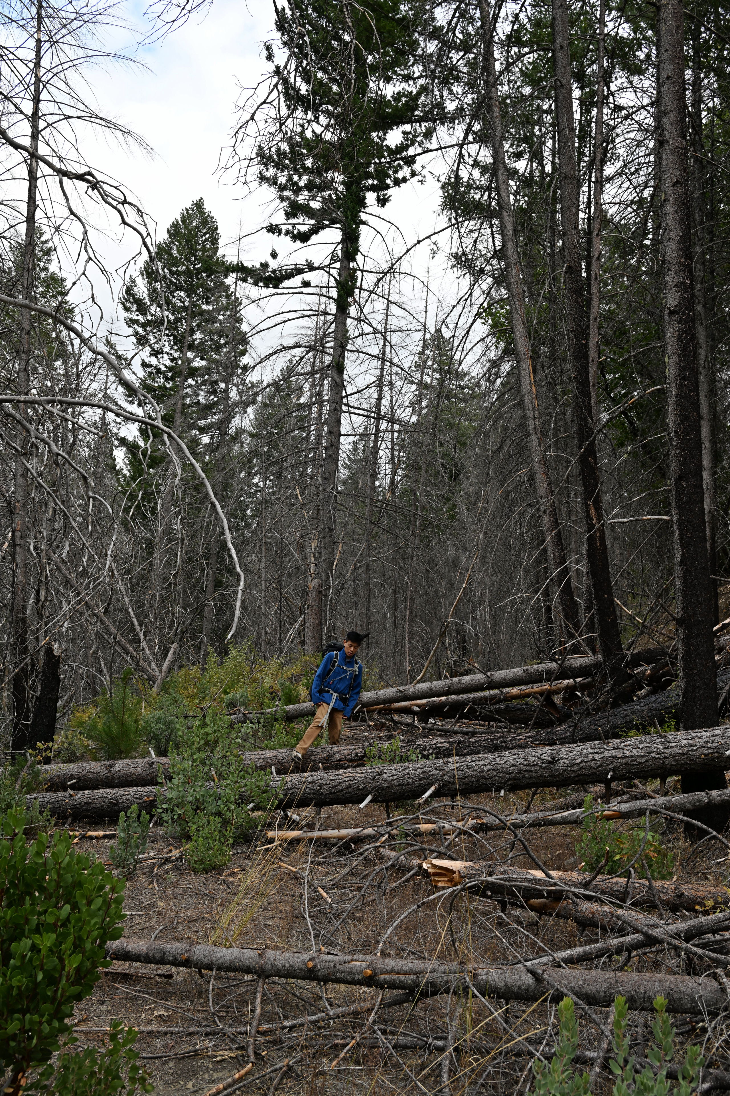
The early part especially of the Deafy Glade Trail, 8W26, in Mendocino National Forest, was in rough condition. We had to do a bit of bushwhacking through thistles, thorned bushes and burrs to get through. And of course we climed over many downed trees.
The early part especially of the Deafy Glade Trail, 8W26, in Mendocino National Forest, was in rough condition. We had to do a bit of bushwhacking through thistles, thorned bushes and burrs to get through. And of course we climed over many downed trees.
The early part especially of the Deafy Glade Trail, 8W26, in Mendocino National Forest, was in rough condition. We had to do a bit of bushwhacking through thistles, thorned bushes and burrs to get through. And of course we climed over many downed trees.
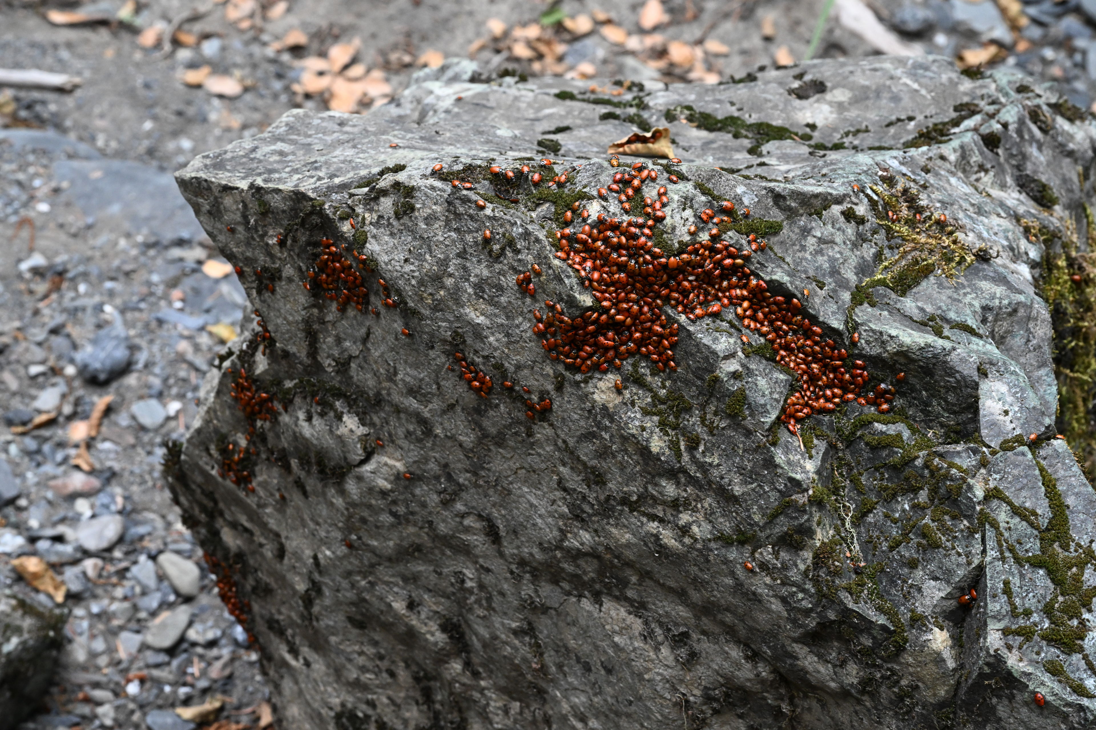
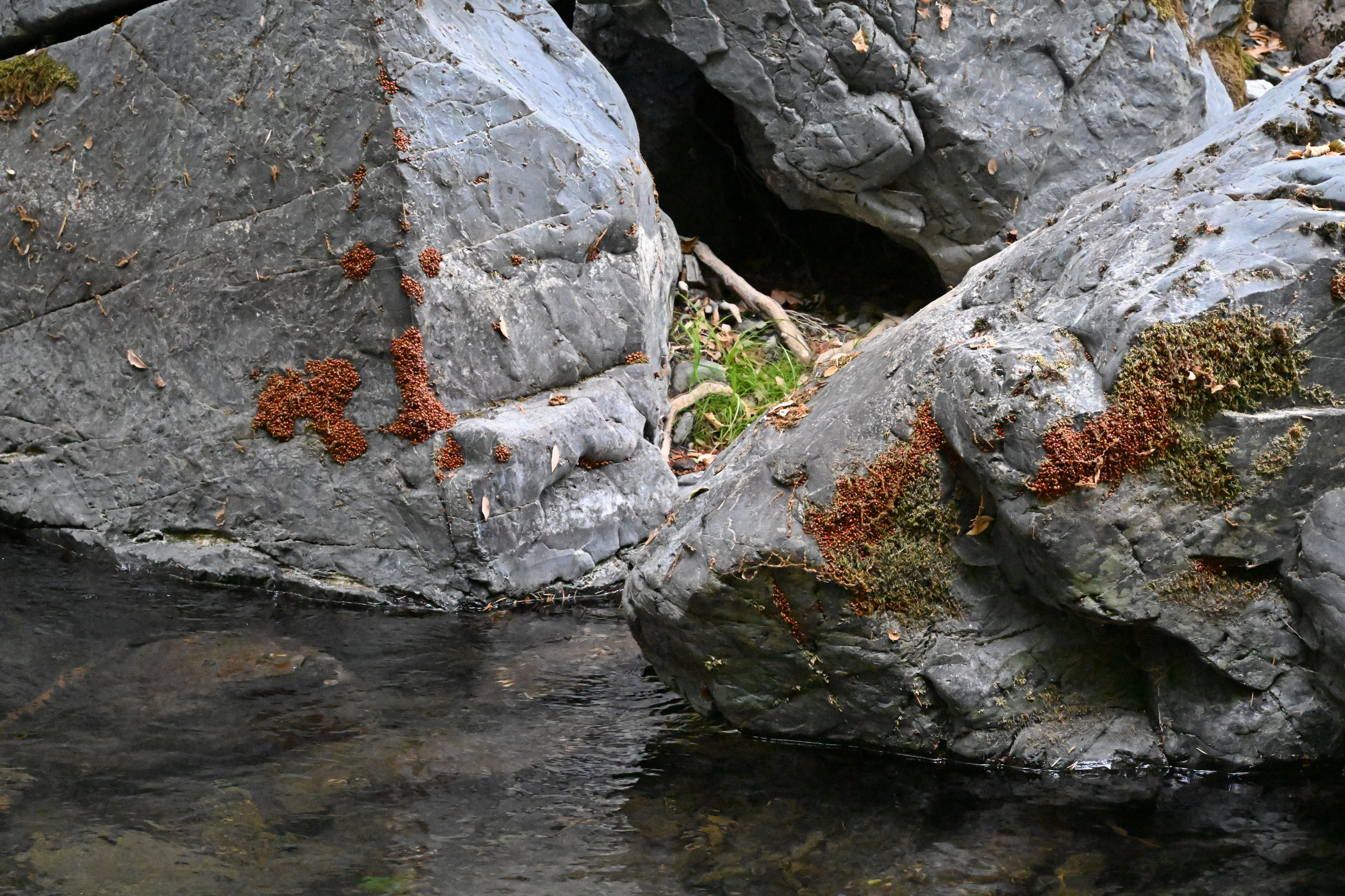
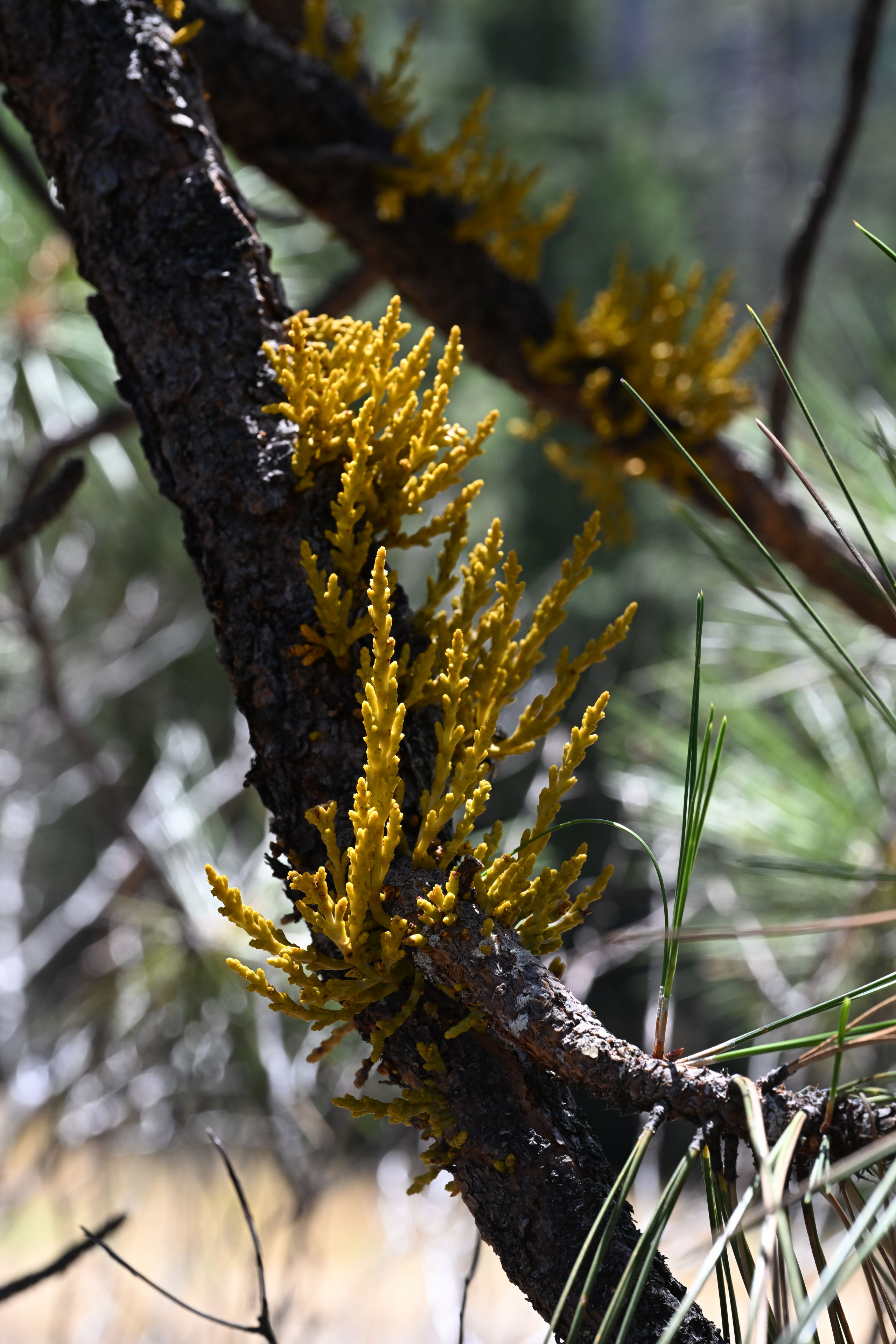
Once we got near the water, there were tons of ladybugs in large masses in crevices of rocks and trees.

We came upon tons of ladybugs clustered around the ends of logs and rocks on the Deafy Glade Trail, 8W26, in Mendocino National Forest.
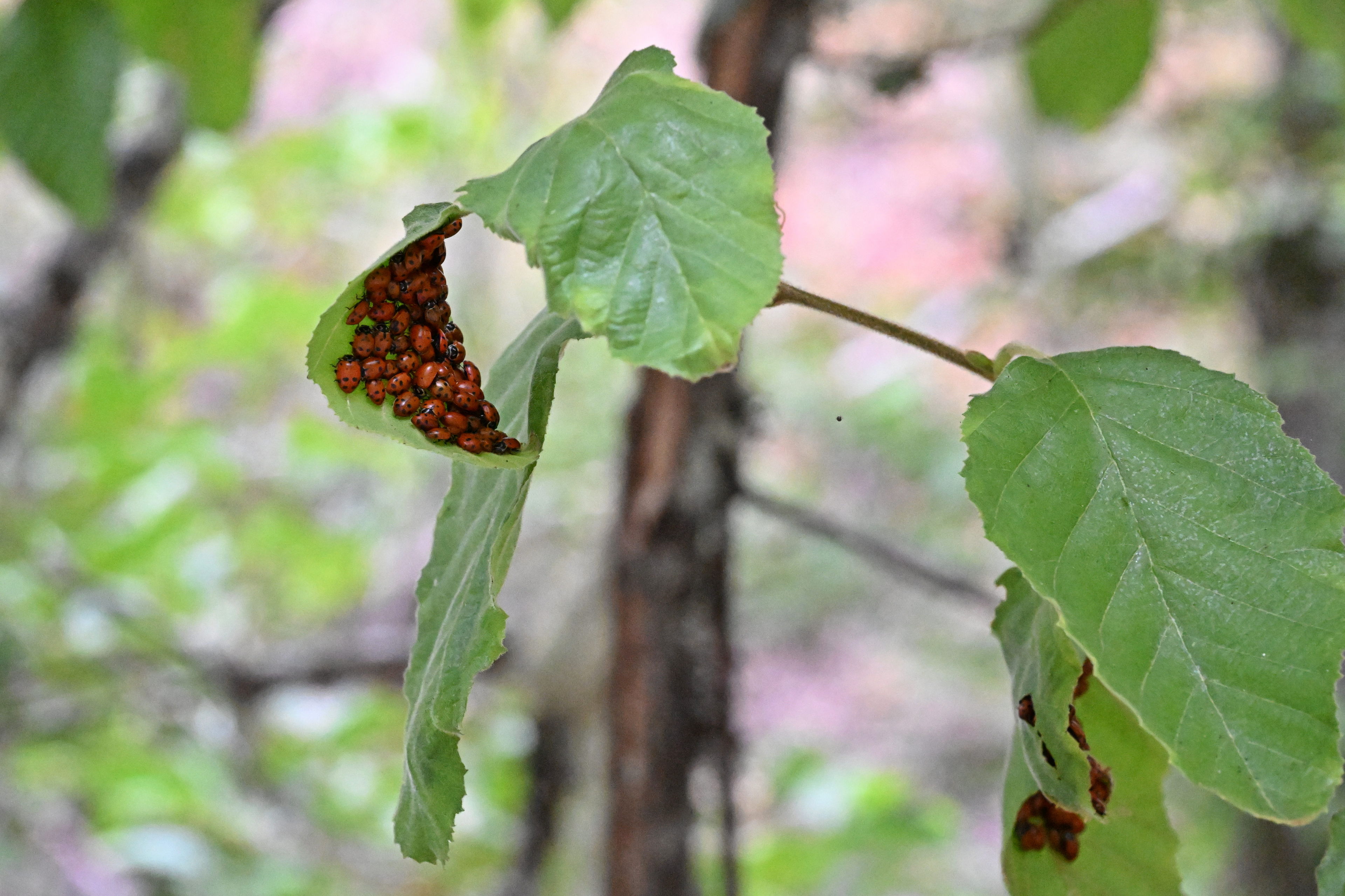
We came upon tons of ladybugs clustered around the ends of logs and rocks on the Deafy Glade Trail, 8W26, in Mendocino National Forest.
We came upon tons of ladybugs clustered around the ends of logs and rocks on the Deafy Glade Trail, 8W26, in Mendocino National Forest.
We came upon tons of ladybugs clustered around the ends of logs and rocks on the Deafy Glade Trail, 8W26, in Mendocino National Forest.
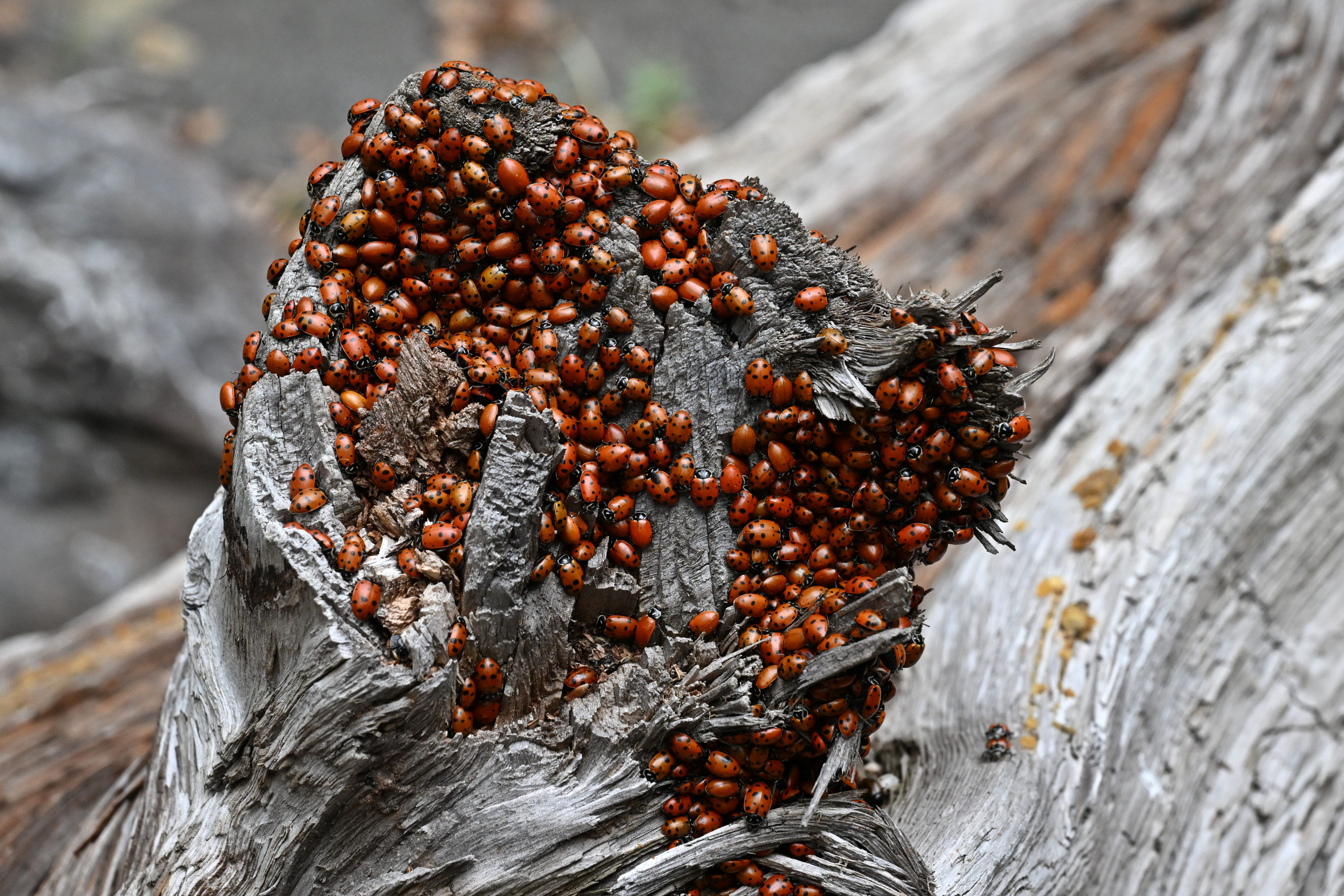
This is where we lost the Deafy Glade Trail by missing where it crossed the river. We proceeded climbing over tons of ladybug covered dead wood for 100 yards before realizing we were definitely off track and backtracking.
We came upon tons of ladybugs clustered around the ends of logs and rocks on the Deafy Glade Trail, 8W26, in Mendocino National Forest.
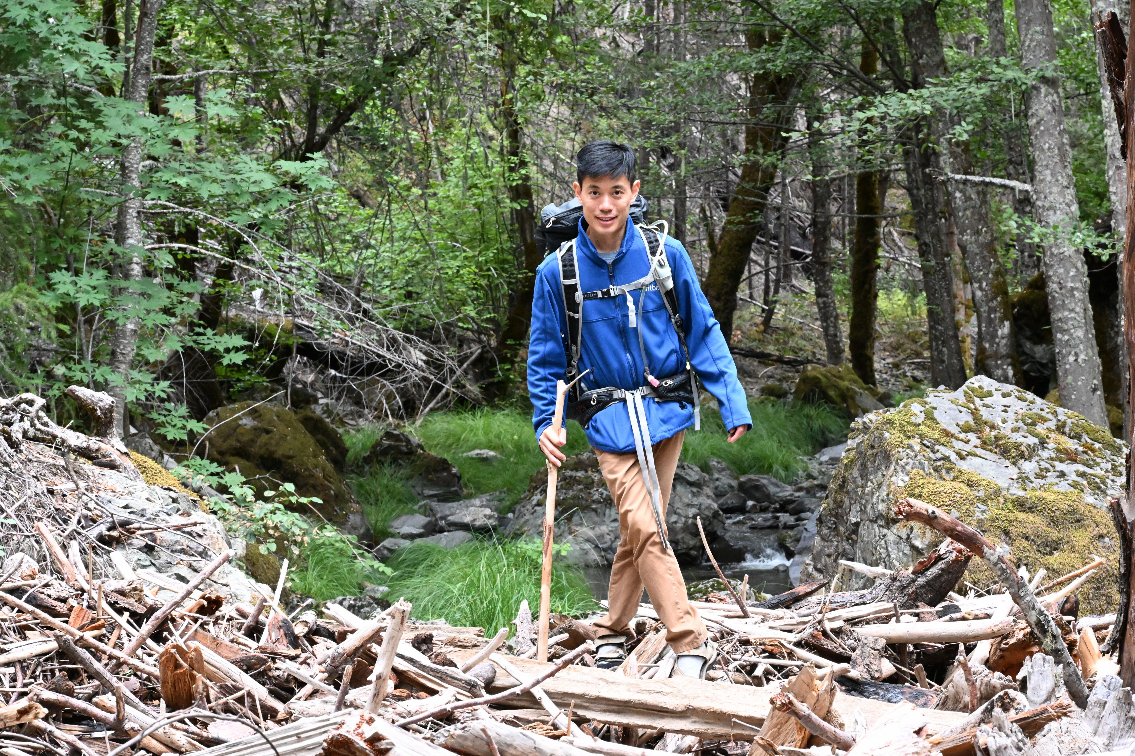
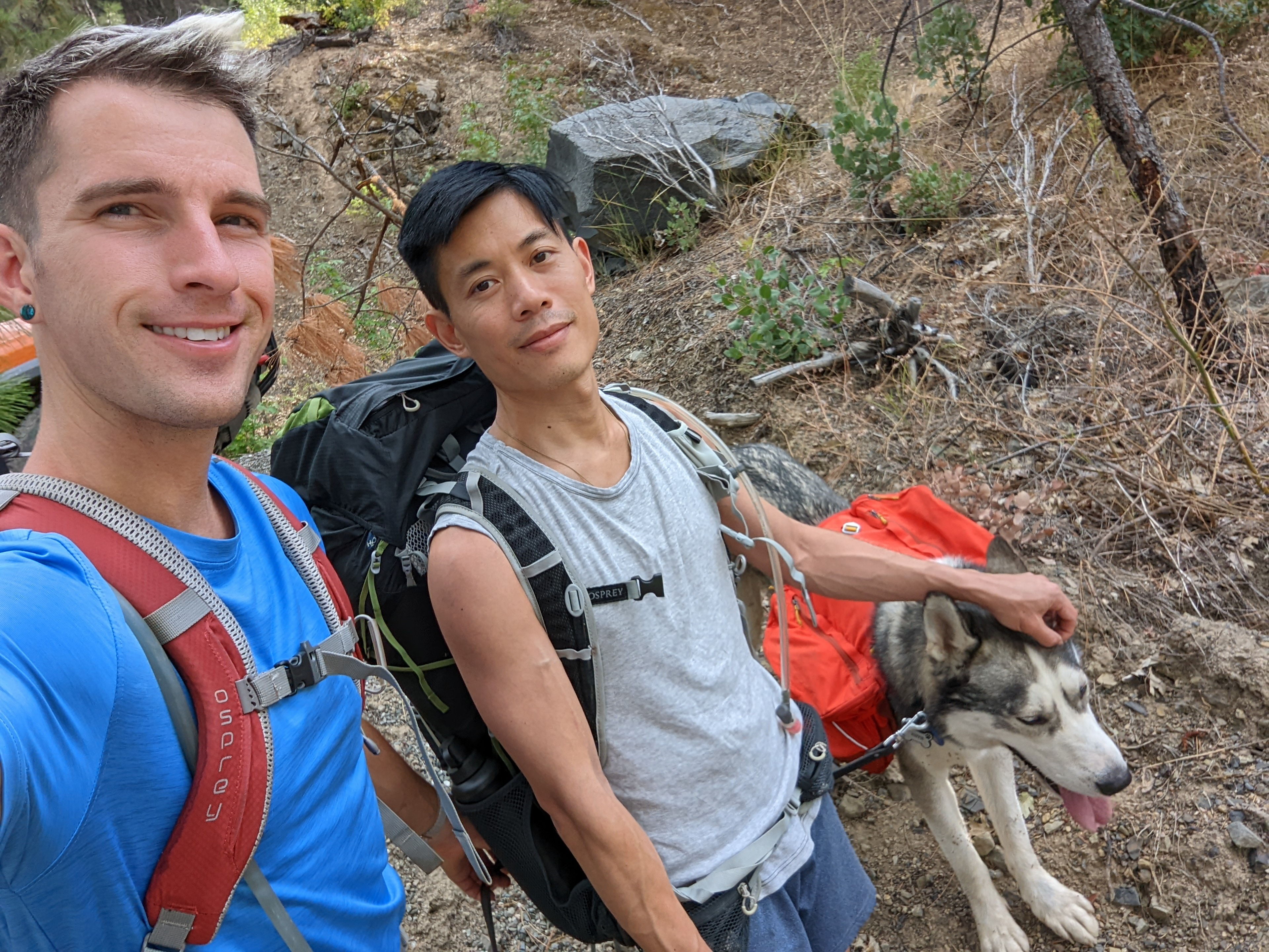
Hiking on the Deafy Glade Trail, 8W26, in Mendocino National Forest.
Once we got about 100 yards past where the trail was supposed to cross the water, I knew we definitely lost it because I couldn’t fathom where it would continue without scaling the side of a cliff. We backtracked, and then I saw what was apparently supposed to be a small rock bridge for us to jump across (not pictured). Once we got past that, it was already getting dark, and we happened to find a very suitable camping spot. We decided to just set up, even though we only hiked between one and two miles. Ruffie seemed very tired somehow.
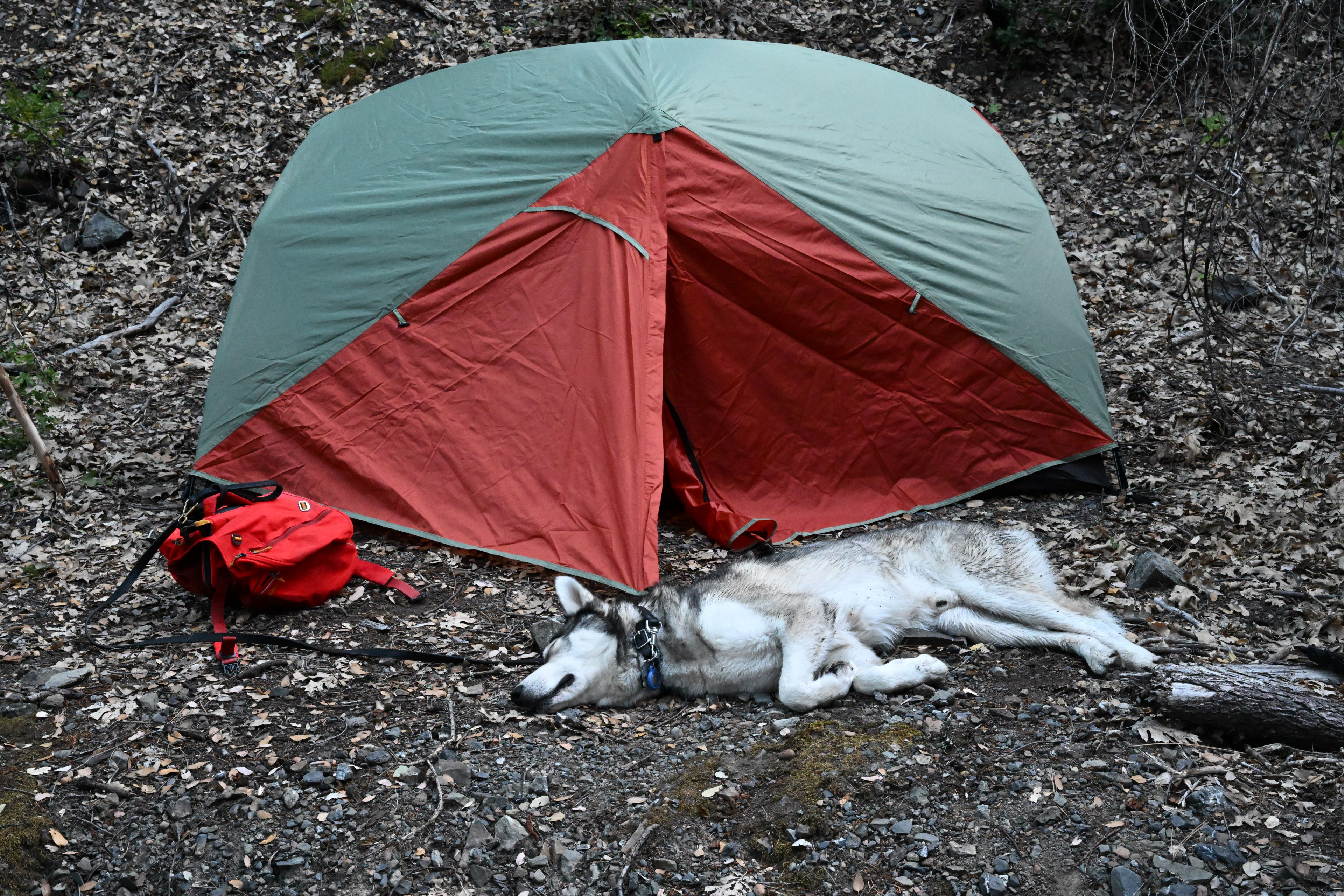
We ended up setting up camp just off the Deafy Glade Trail (8W26 in Mendocino National Forest) in a site someone had used previously, as it had a bit of a fire pit set up next to a flat area. We were aiming to follow the rule to camp 200 feet away from trails, but it was getting dark fast and I was getting worried about running into bears and was certain nobody else would be passing through.
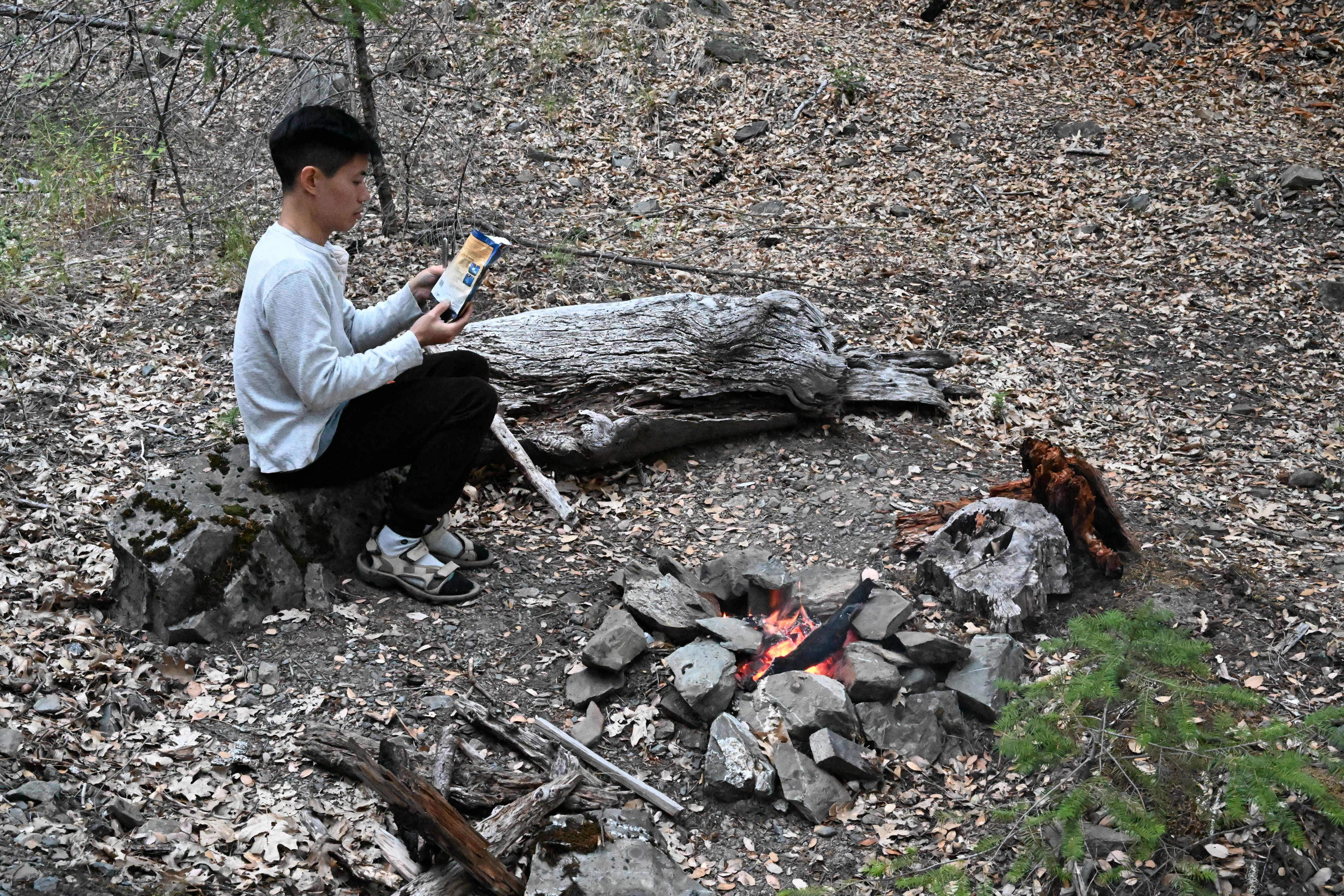
Alan built a small fire to heat some water for our freeze dried dinners and to make tea.
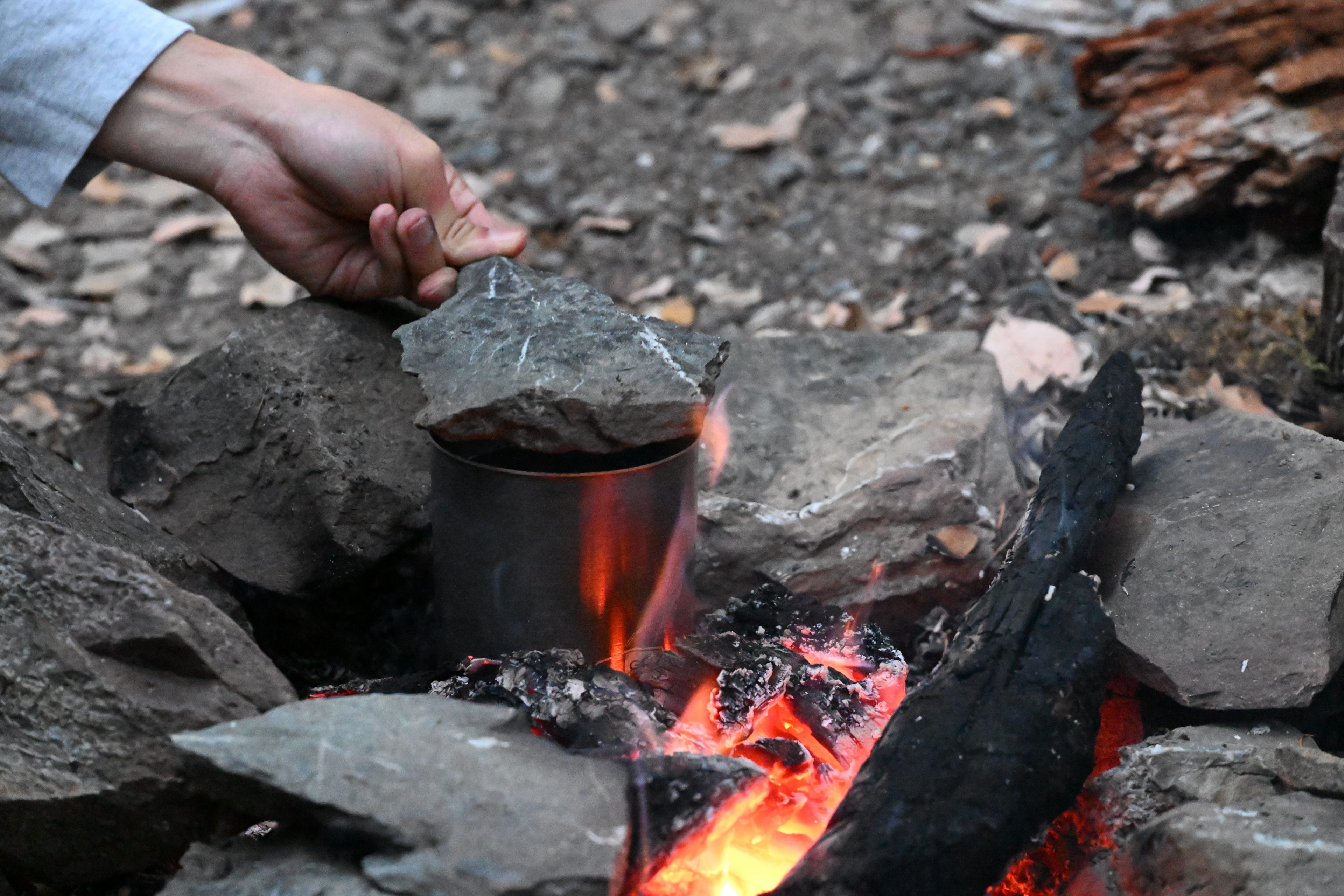
Alan built a small fire to heat some water for our freeze dried dinners and to make tea.
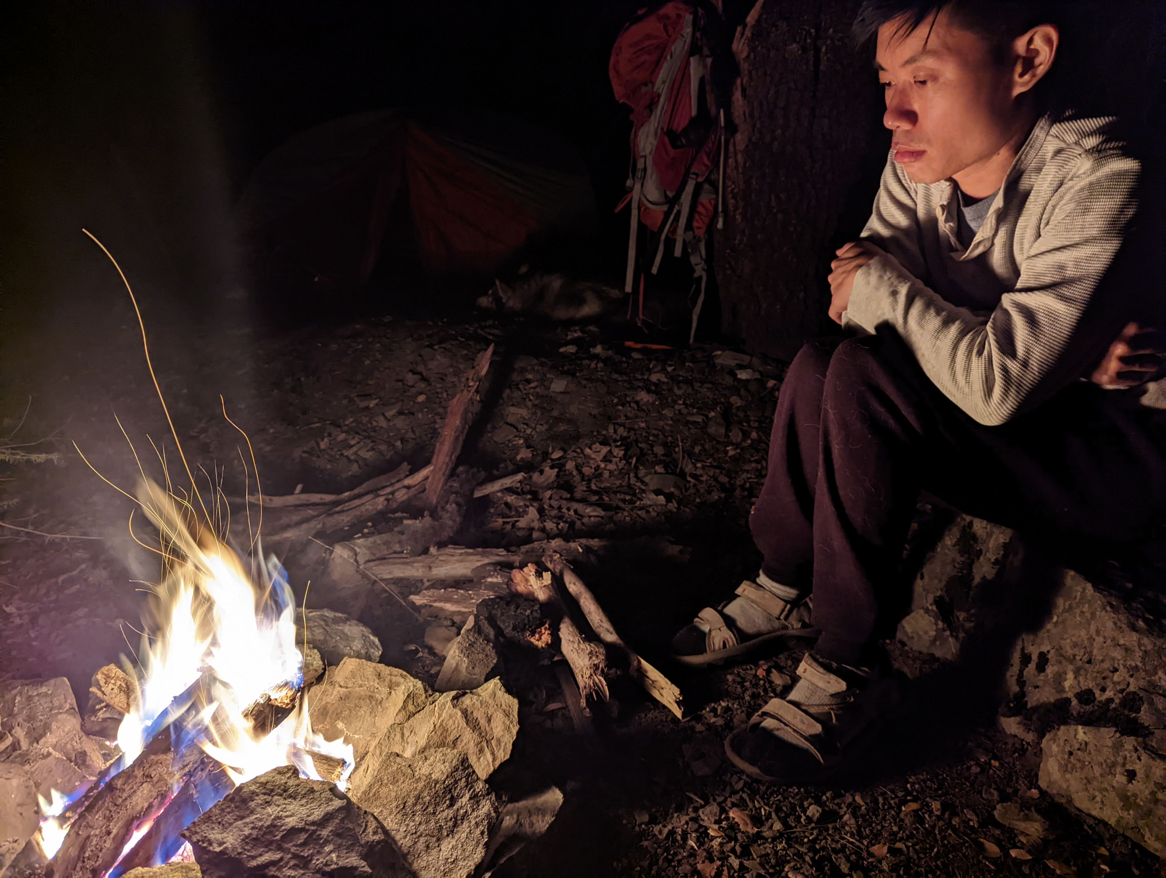
Alan built a small fire to heat some water for our freeze dried dinners and to make tea.
At night we initially couldn’t see stars due to clouds, but it cleared up. At one point we definitely saw a recent batch of launched SpaceX satellites fly by. It looked like a string of more than a dozen UFOs. I didn’t get video because I was in disbelief that there would continue to be as many as there were! Still you can see how many stars were visible, even without a tripod for my camera!
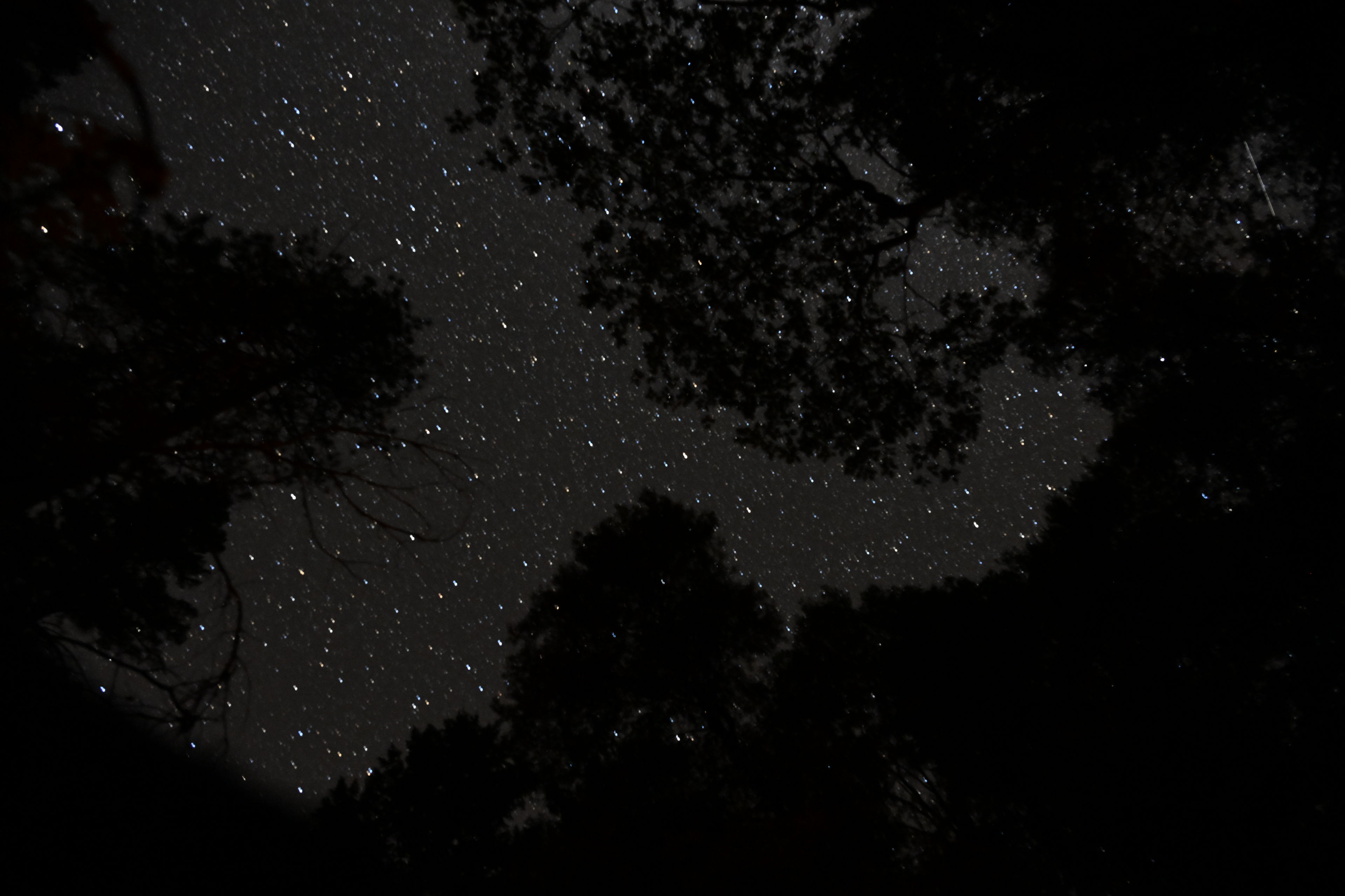
Night sky above the Deafy Glade Trail, 8W26, in Mendocino National Forest.
Our little campsite along the Deafy Glade Trail (8W26, in Mendocino National Forest)
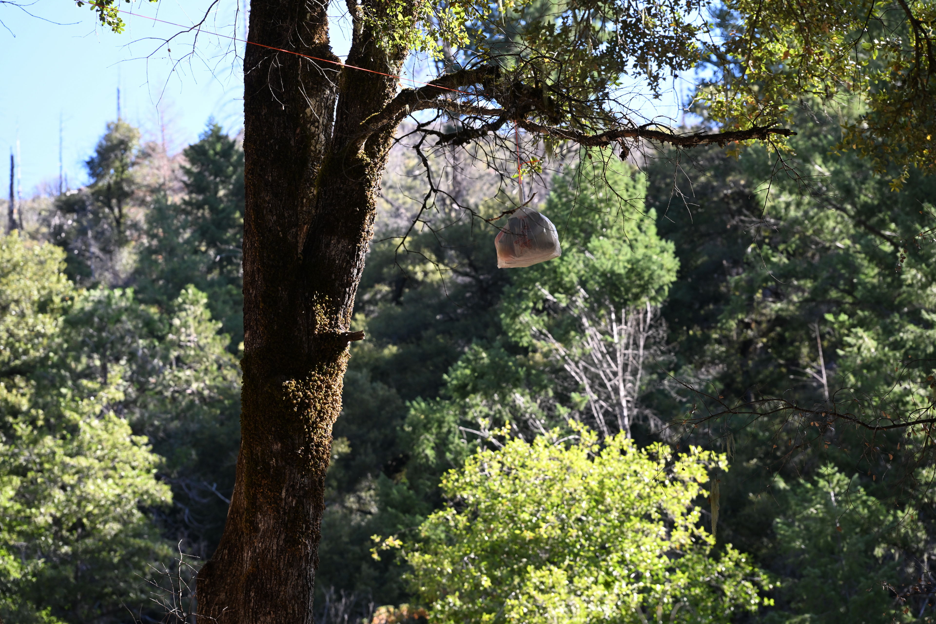
I put what little potentially smelly food we had in a plastic bag and suspended it from a tree about 100 feet from our campsite. It wasn't as bear proof as I'd like, but I figured it would be good enough, and it turned out fine.
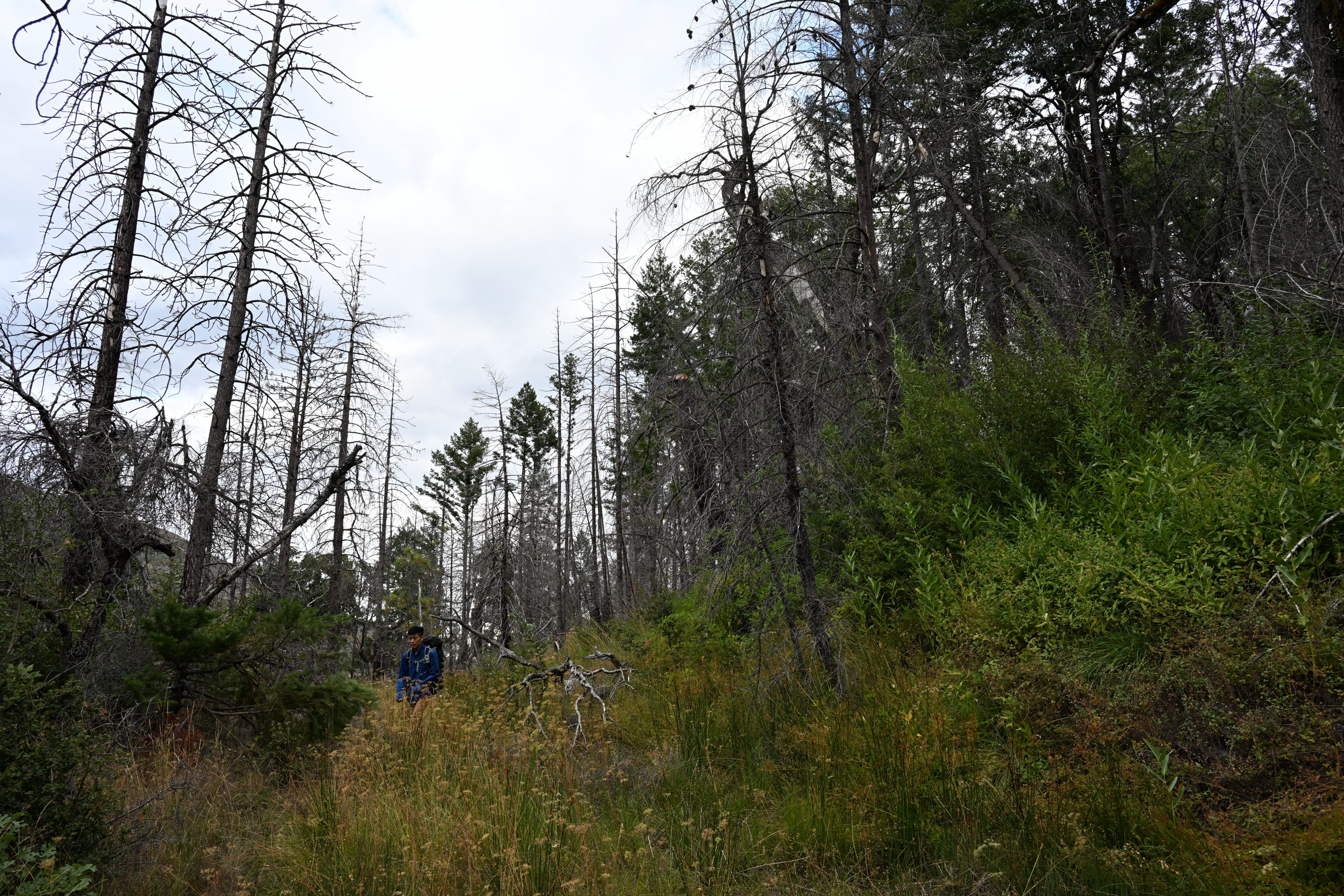
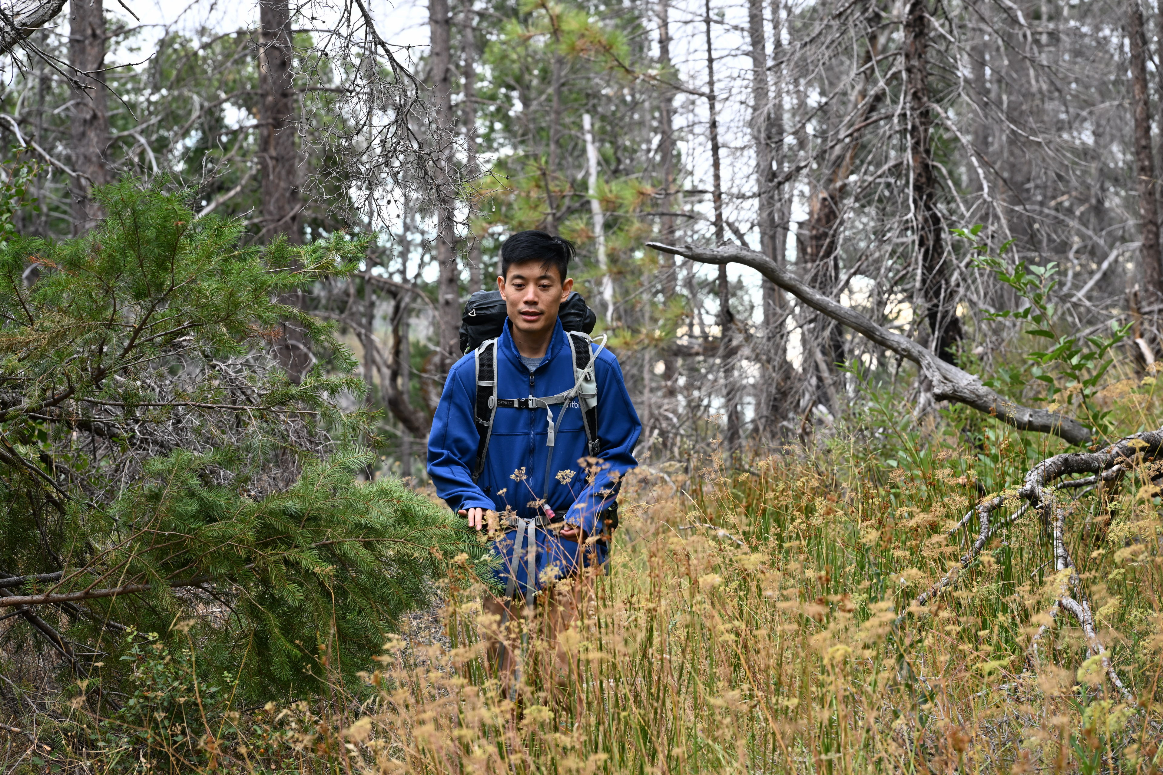
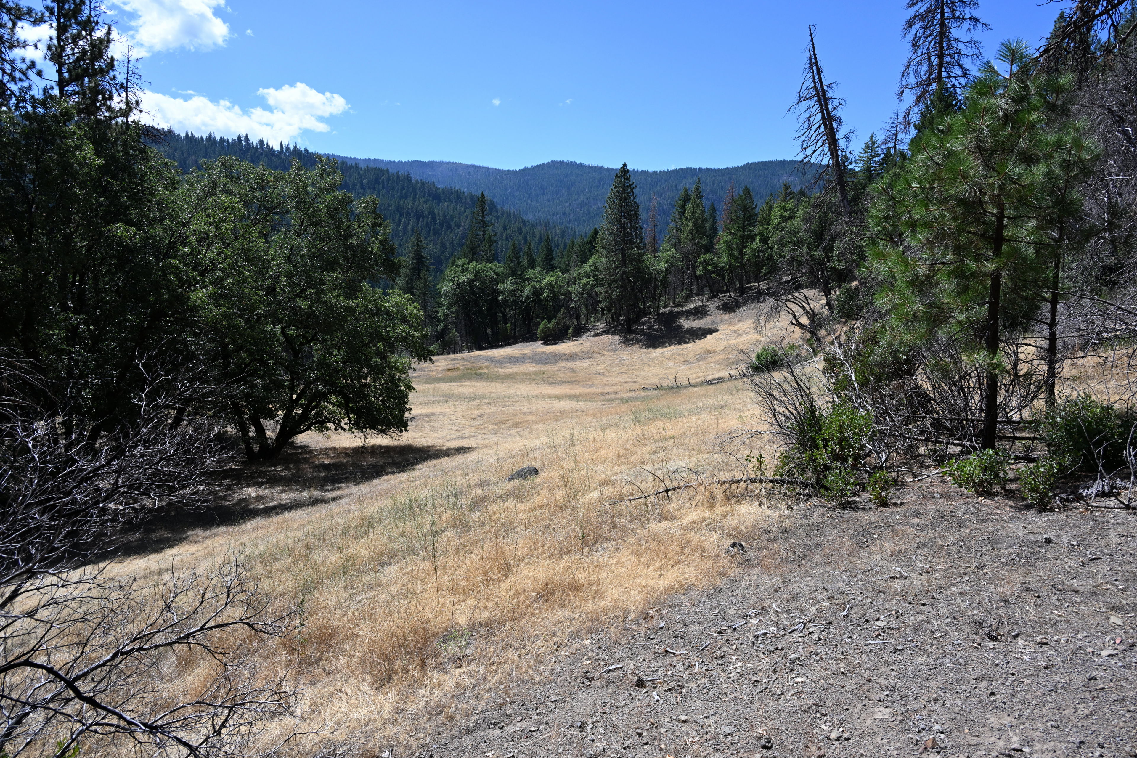
The next day, we decided to hike further up the trail without as much gear, and then pack up the campsite on our way back down. We managed to go about 5 miles total.
Hiking on the Deafy Glade Trail, 8W26, in Mendocino National Forest.
Hiking on the Deafy Glade Trail, 8W26, in Mendocino National Forest.
Hiking on the Deafy Glade Trail, 8W26, in Mendocino National Forest.

Hiking on the Deafy Glade Trail, 8W26, in Mendocino National Forest.
Hiking on the Deafy Glade Trail, 8W26, in Mendocino National Forest.
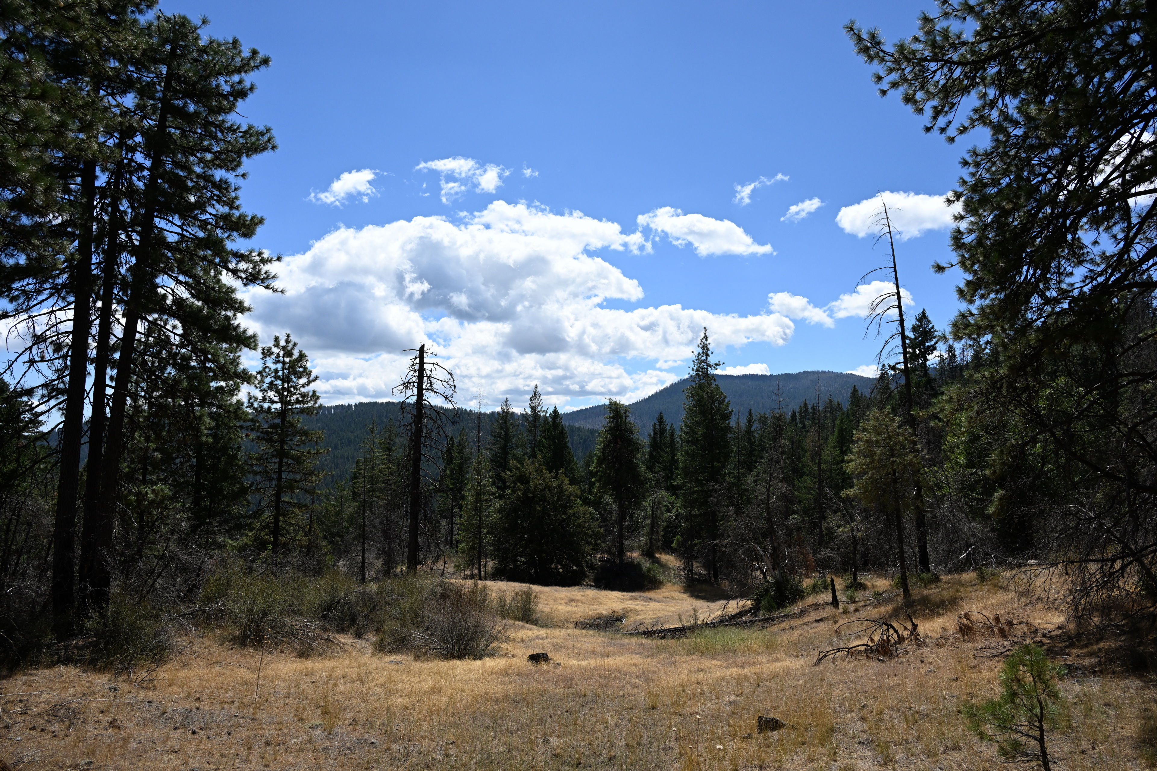
Hiking on the Deafy Glade Trail, 8W26, in Mendocino National Forest.
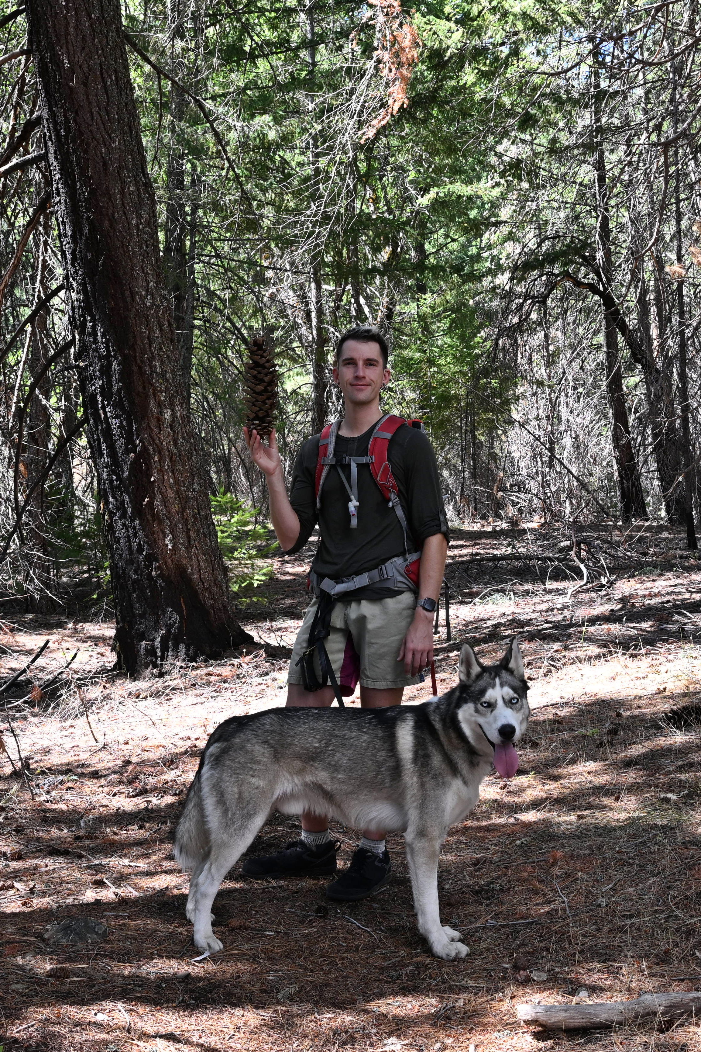
Hiking on the Deafy Glade Trail, 8W26, in Mendocino National Forest.
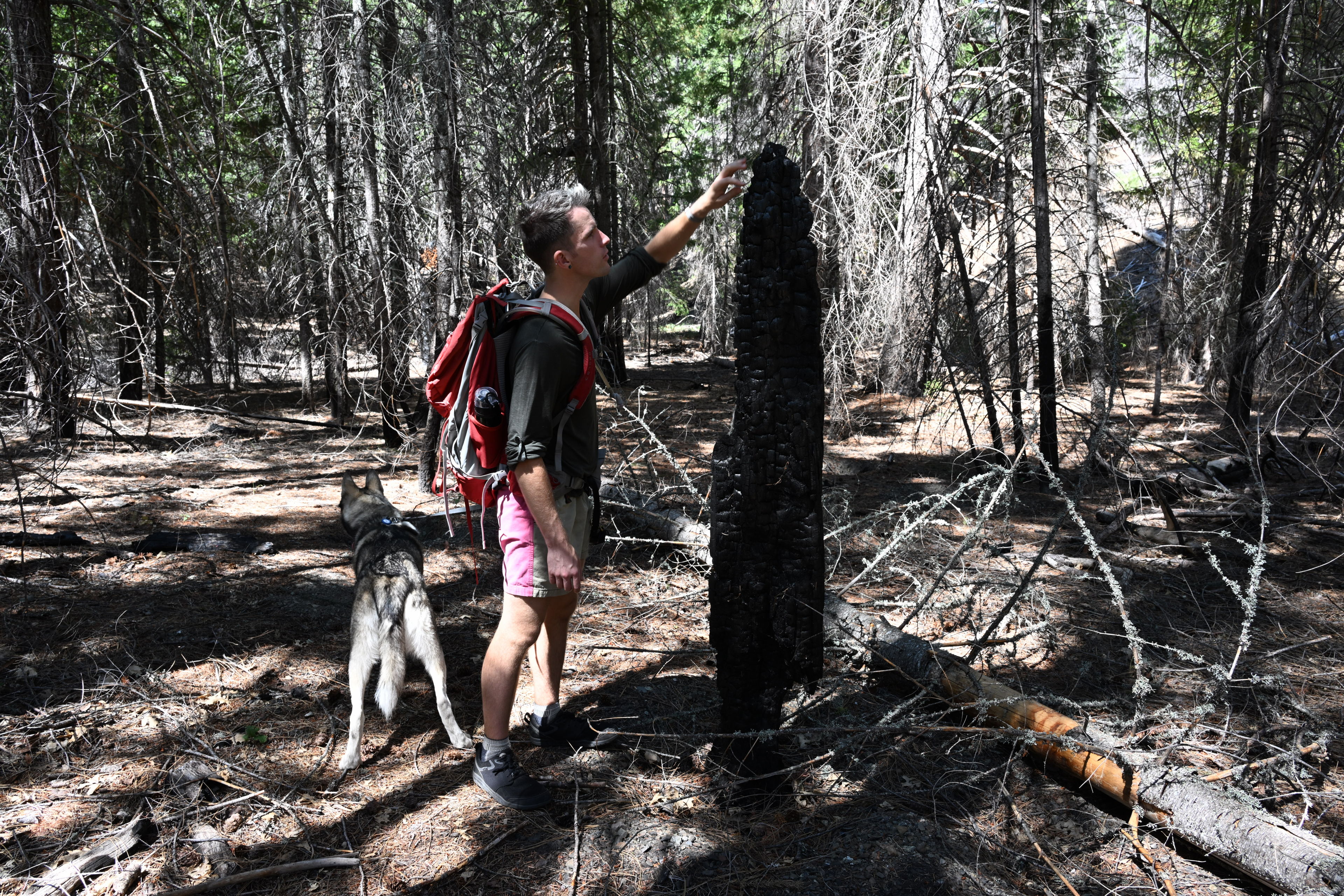
Hiking on the Deafy Glade Trail, 8W26, in Mendocino National Forest.
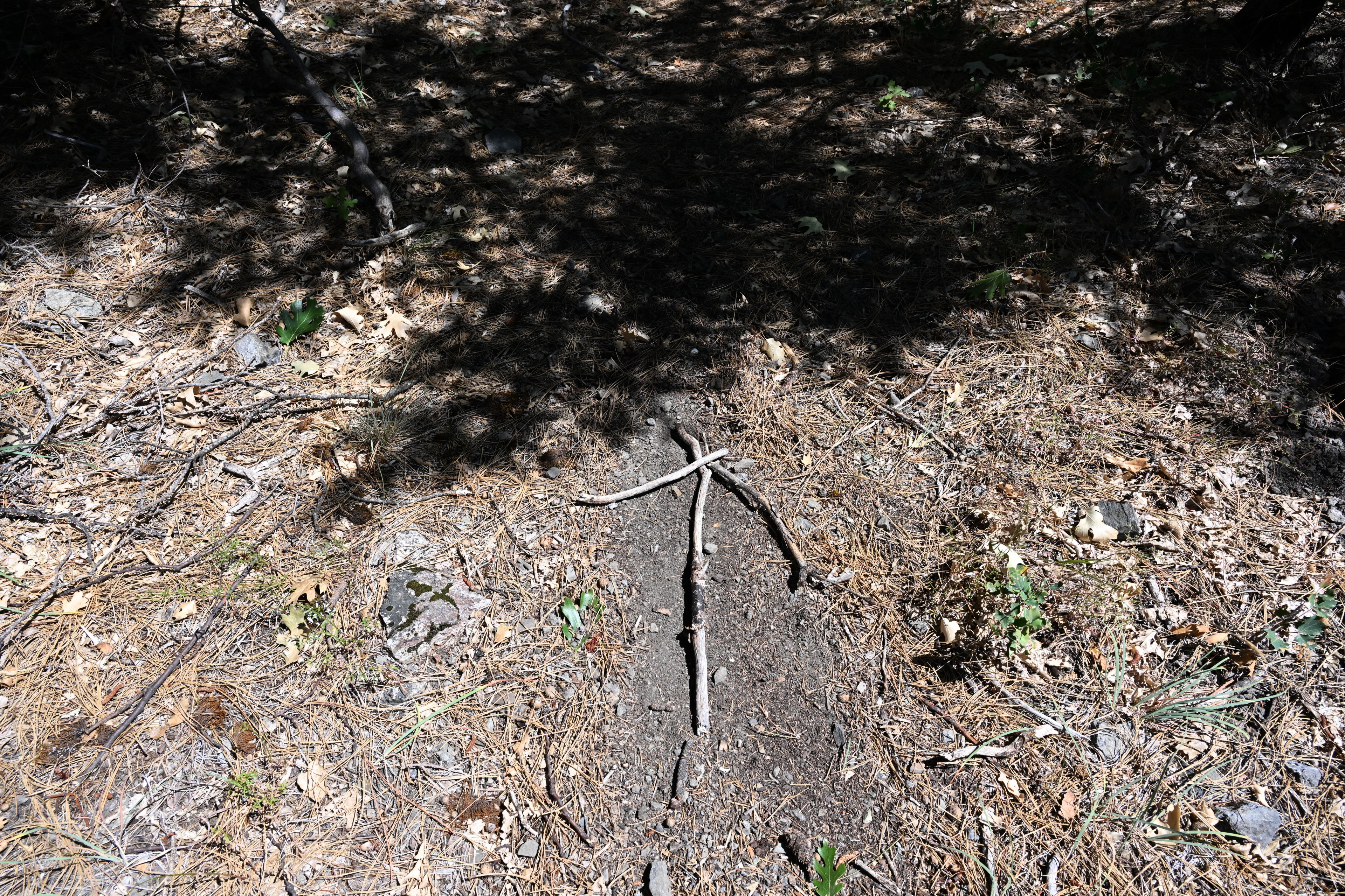
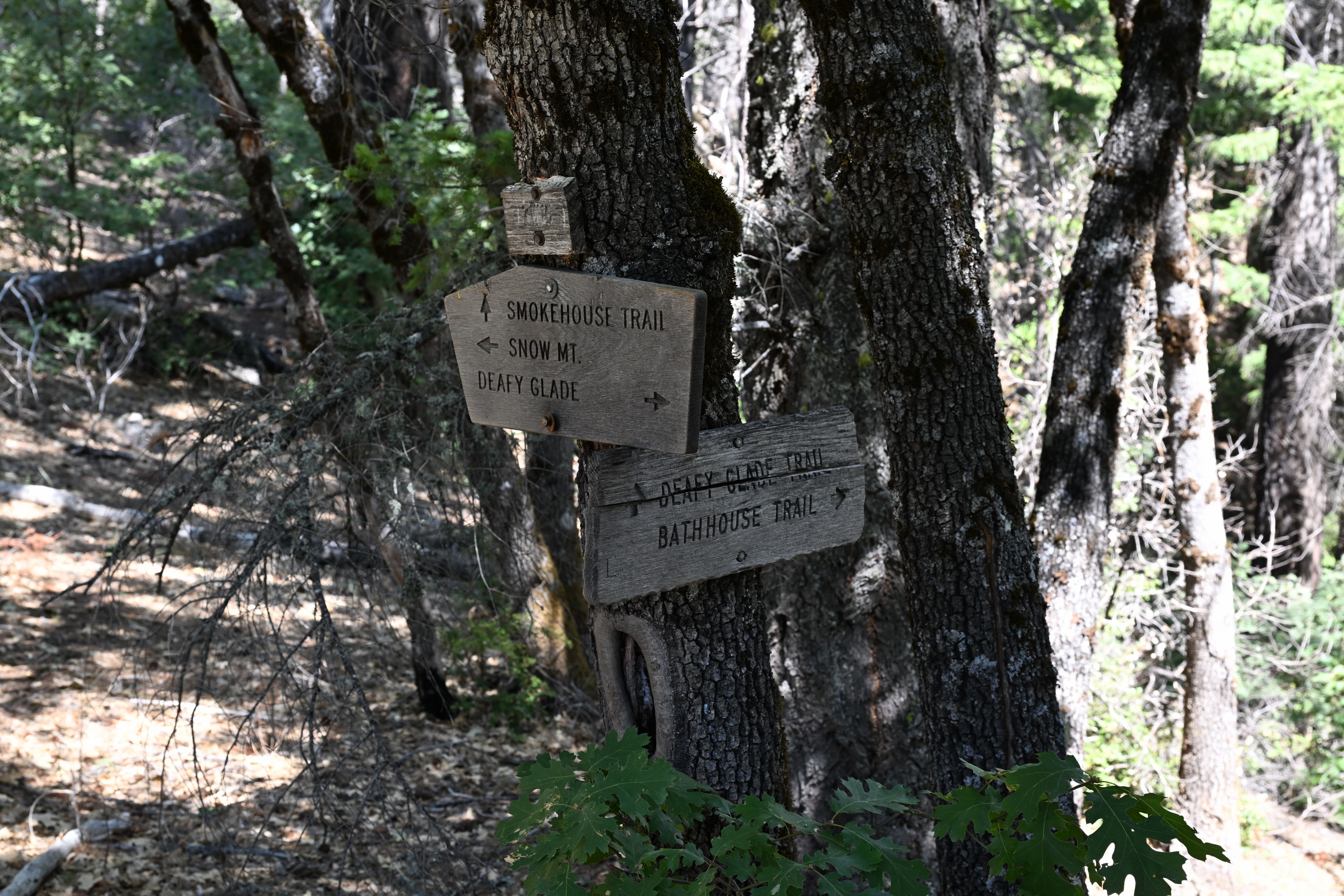
Someone created an arrow pointing toward the path in an area we also lost our way a bit, while hiking on the Deafy Glade Trail, 8W26, in Mendocino National Forest.
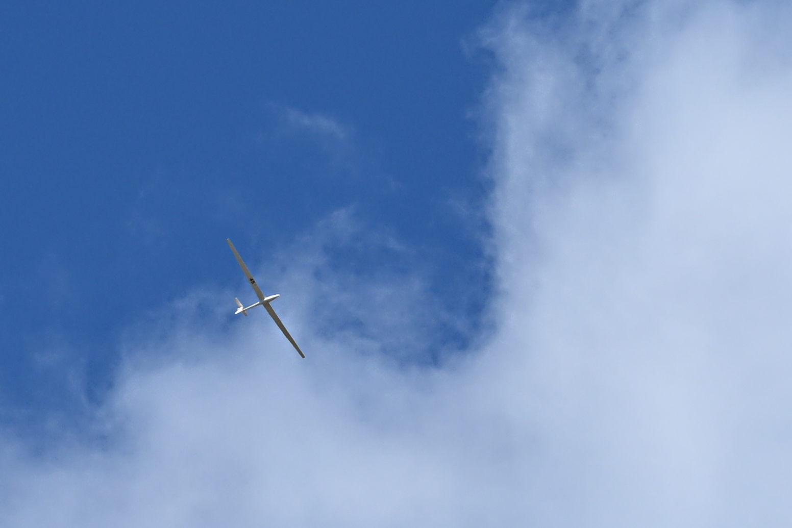
I spotted some kind of glider aircraft doing circles high above us. It seemed silent at first, but when it passed closer overhead, I am pretty sure I heard some kind of motor noise. At first I thought it might be a drone, but after researching some similar looking aircraft, it could have been a 2 seater glider plane. I'm not sure.
Hiking on the Deafy Glade Trail, 8W26, in Mendocino National Forest.
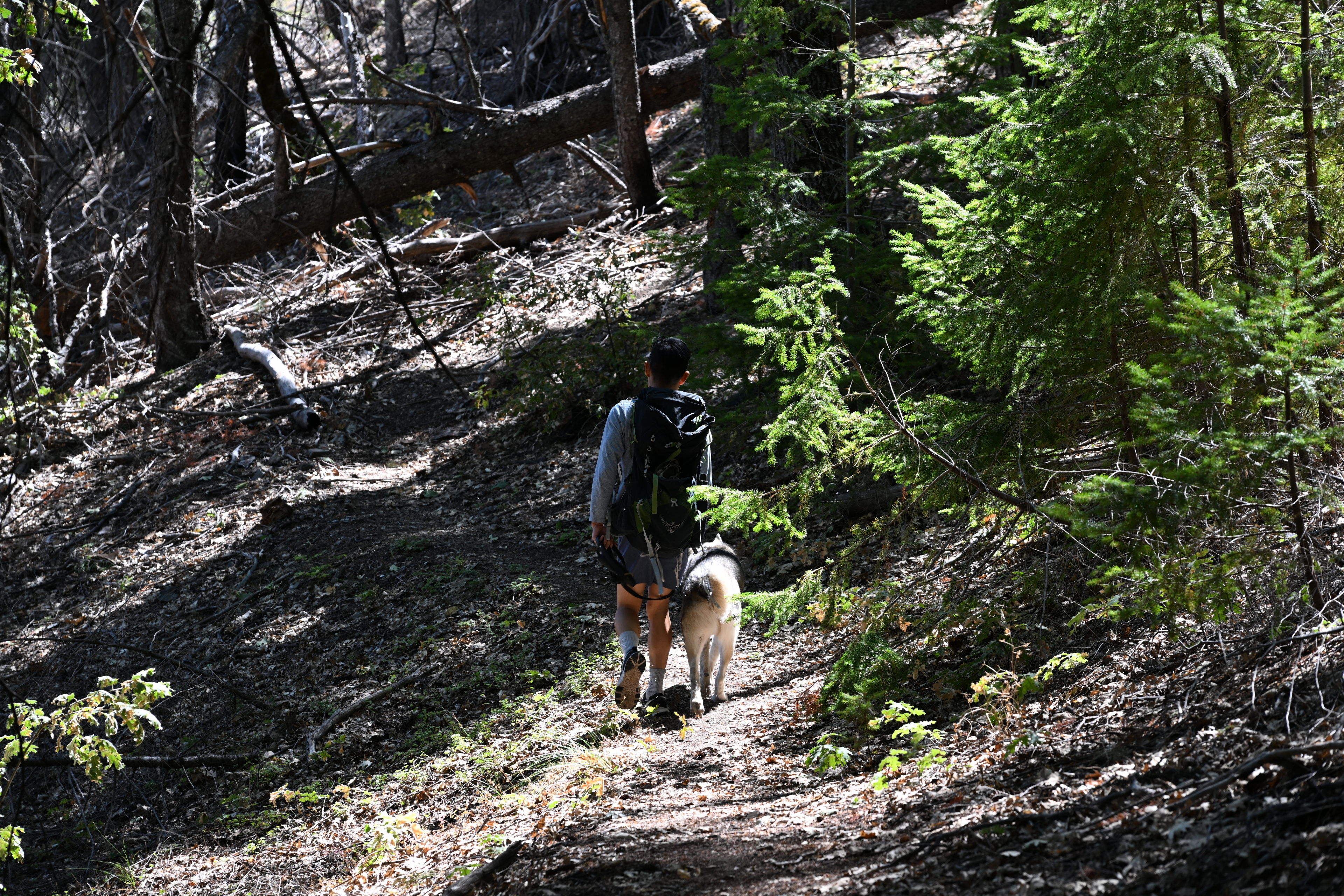
Hiking on the Deafy Glade Trail, 8W26, in Mendocino National Forest.
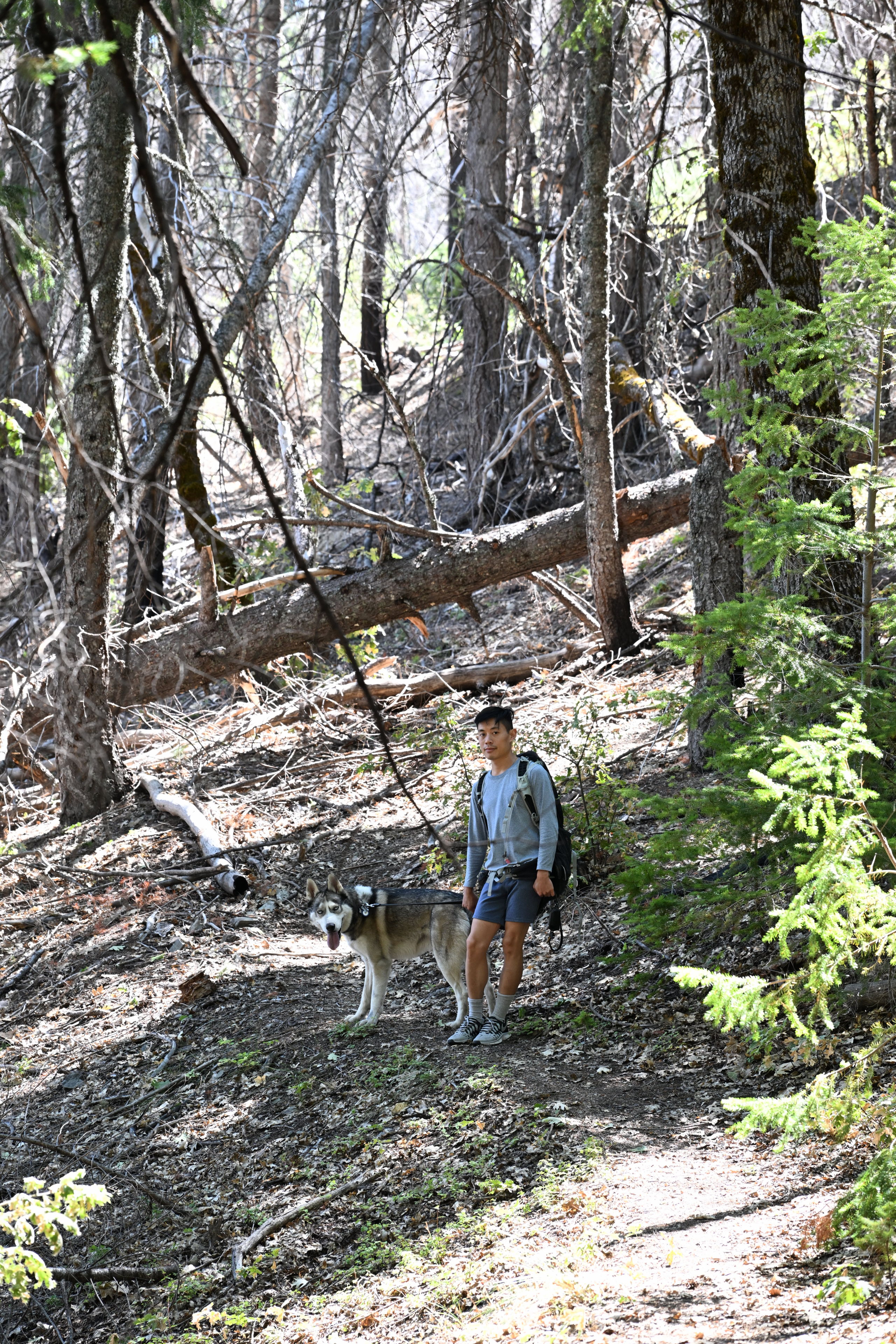
Hiking on the Deafy Glade Trail, 8W26, in Mendocino National Forest.
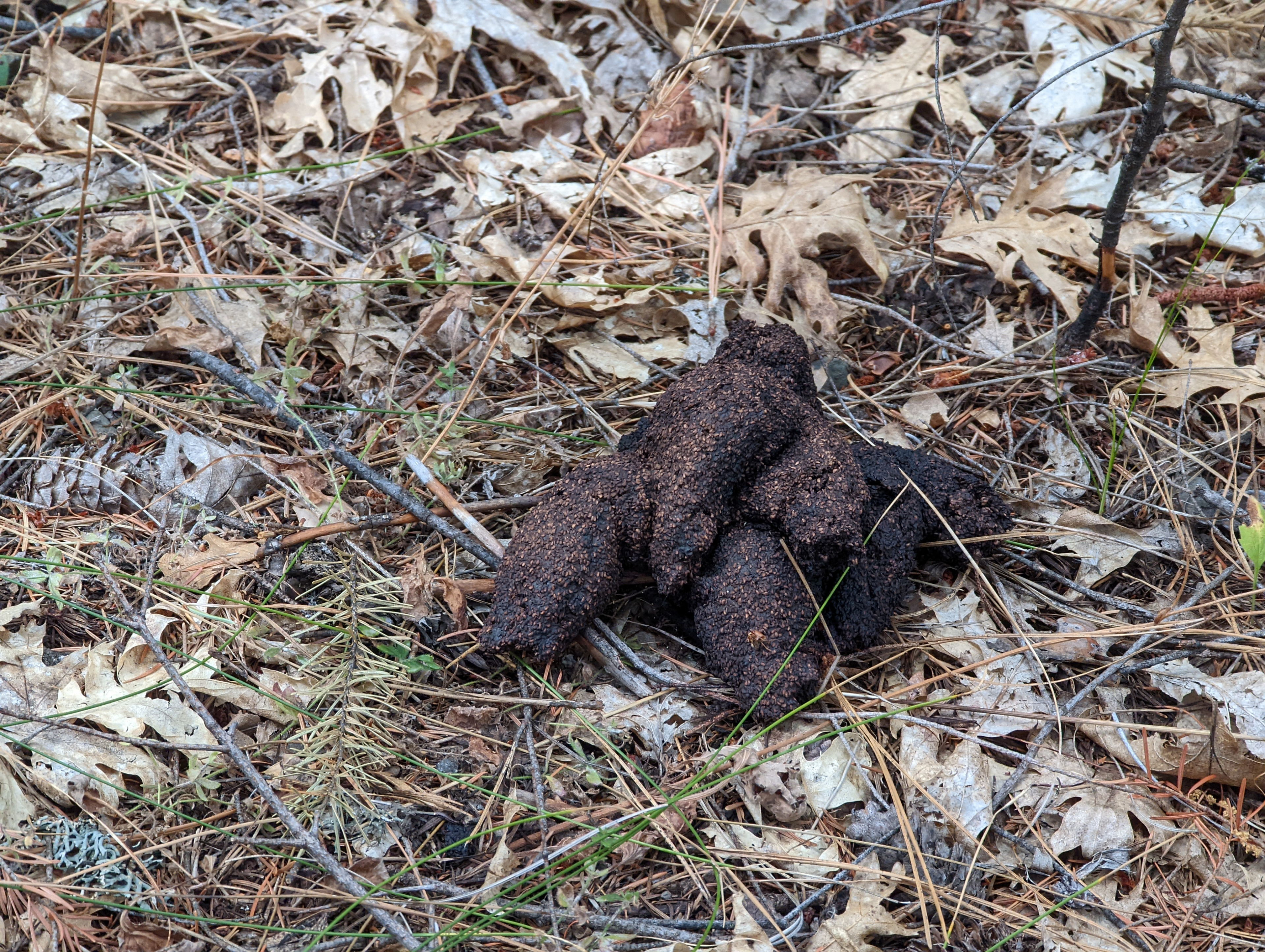
Bears have been in the area somewhat recently. Hiking on the Deafy Glade Trail, 8W26, in Mendocino National Forest.
Hiking on the Deafy Glade Trail, 8W26, in Mendocino National Forest.
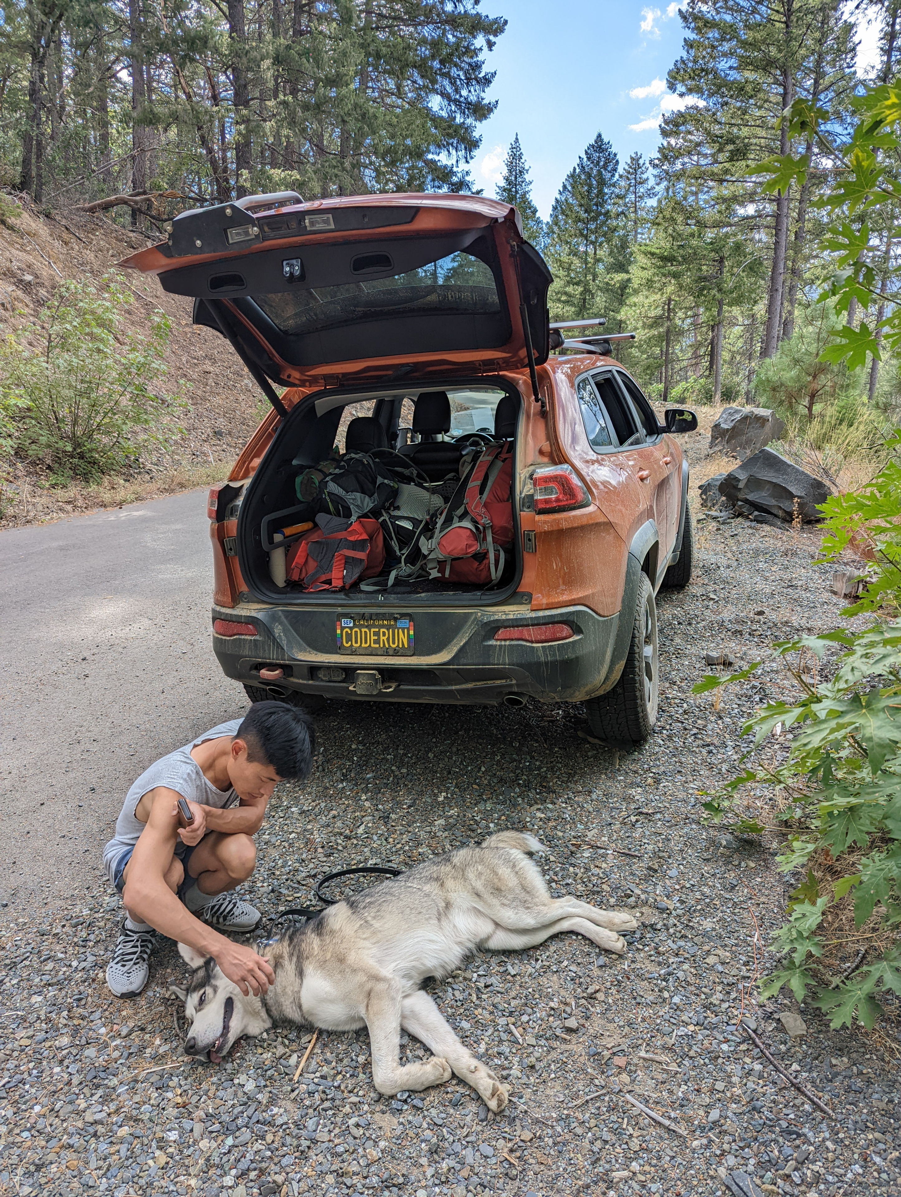
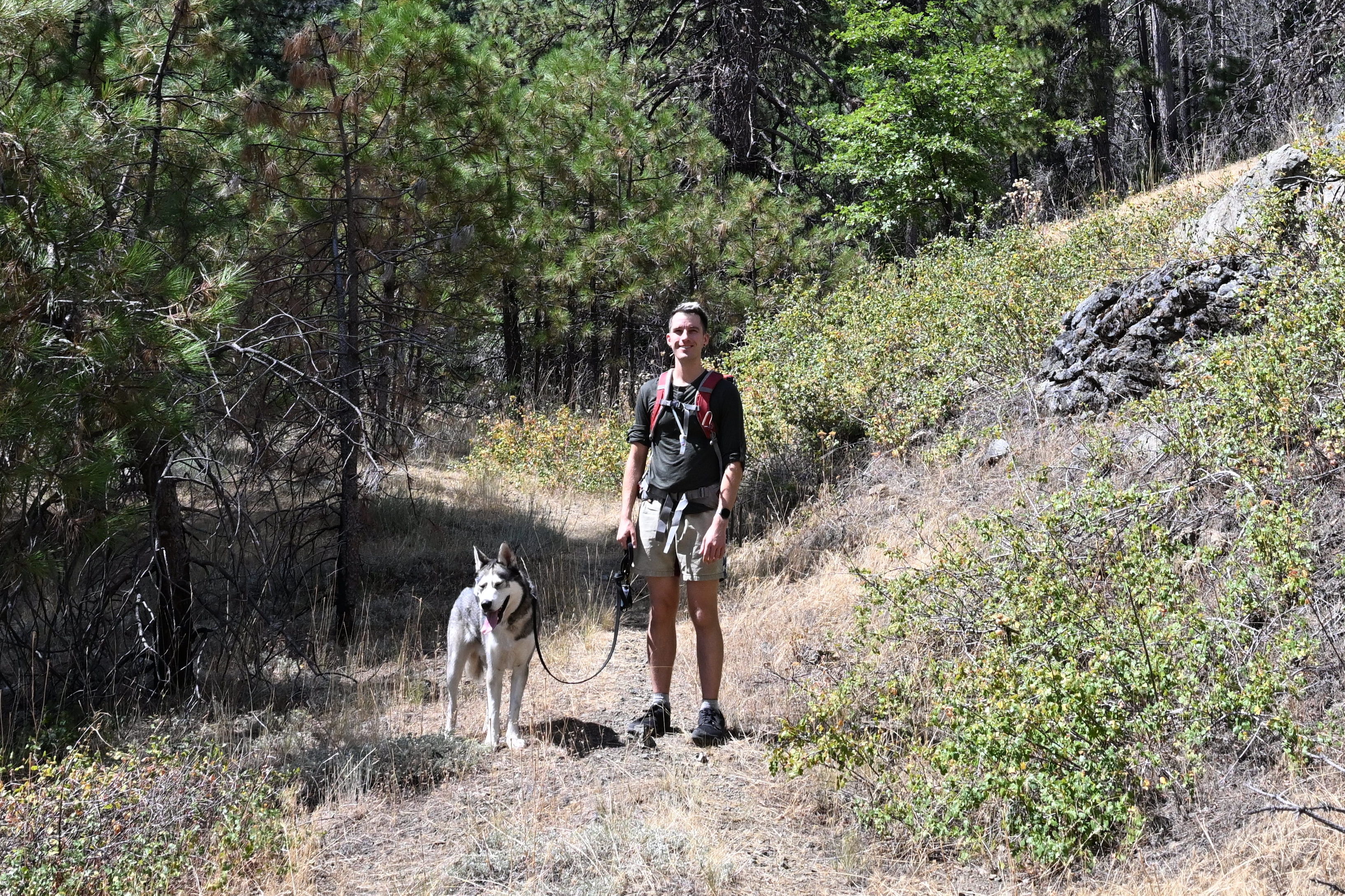
Ruffie was apparently exhausted after our roughly 5 mile hike this afternoon!
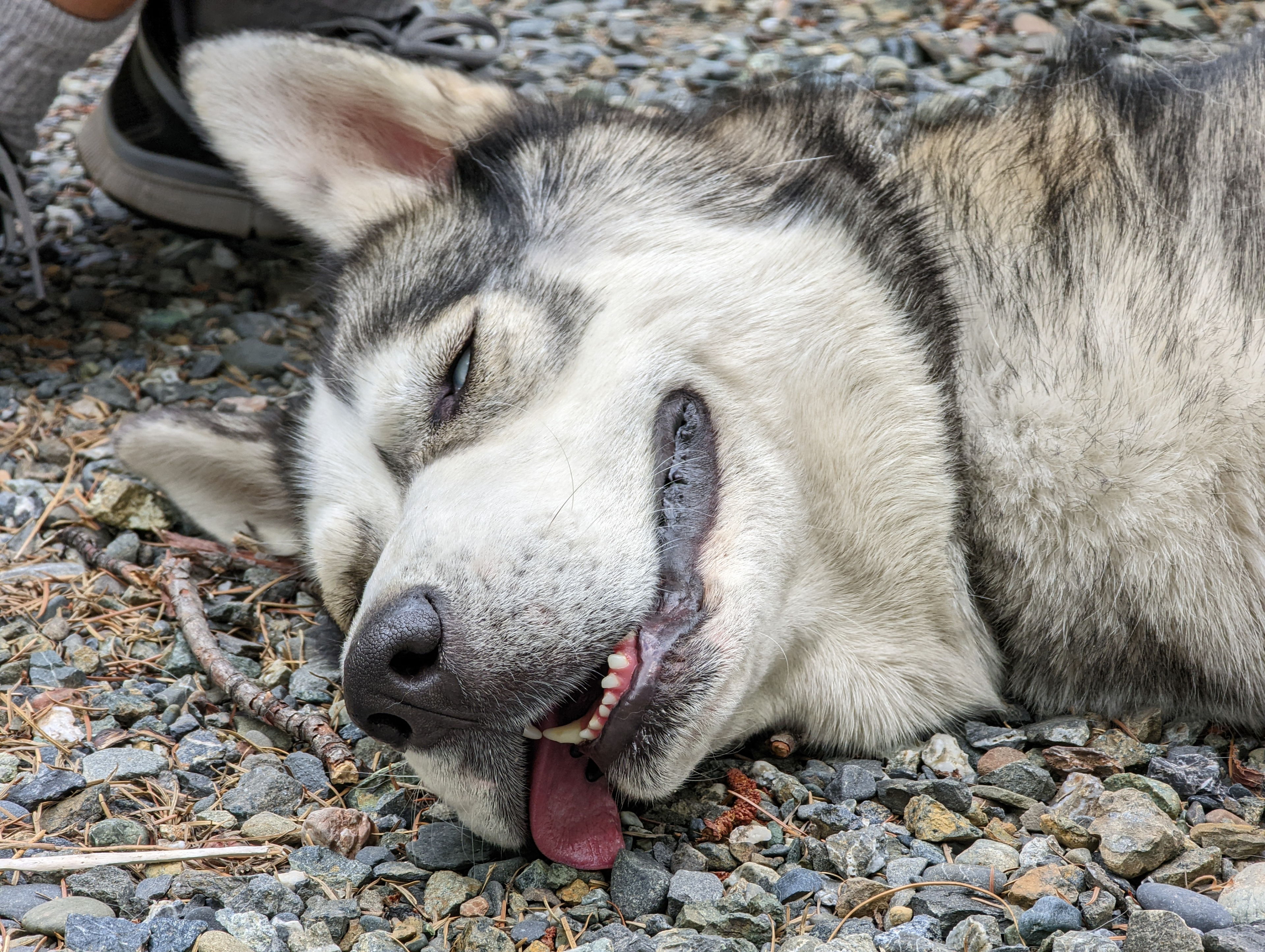
Ruffie was apparently exhausted after our roughly 5 mile hike this afternoon!
We were back to the car at around 17:00. Since we were only a few miles from where the supposed washouts were on M10, we decided to just drive toward it to find out how bad it was before heading back out through the 17N02-M5 route. At least I knew one way that would work that only took about 2 hours, and we wouldn’t need to redo the whole 6 hour exploration.
Driving out was much easier than driving in, because I decided to chance it and disregard the warning from the Forest Service that M10 was impassible above Fouts Springs due to washouts and slides. The issue was apparently rectified enough that we could drive over the problem spots, which allowed us to basically stay on a paved road all the way out, cutting hours off the drive as compared to driving in.
As luck would have it, the Forest Service web page was not updated. I could tell where the washouts had been, but enough work was done that I could drive through. So we were able to take the M10 entirely all the way out of the forest, taking only 30 minutes or so. In total the trip home was around 3 hours, as opposed to the 9 on the way up!
Driving out was much easier than driving in, because I decided to chance it and disregard the warning from the Forest Service that M10 was impassible above Fouts Springs due to washouts and slides. The issue was apparently rectified enough that we could drive over the problem spots, which allowed us to basically stay on a paved road all the way out, cutting hours off the drive as compared to driving in.